Mesoscale Discussion 1951
Issued: · Valid: –
Summary
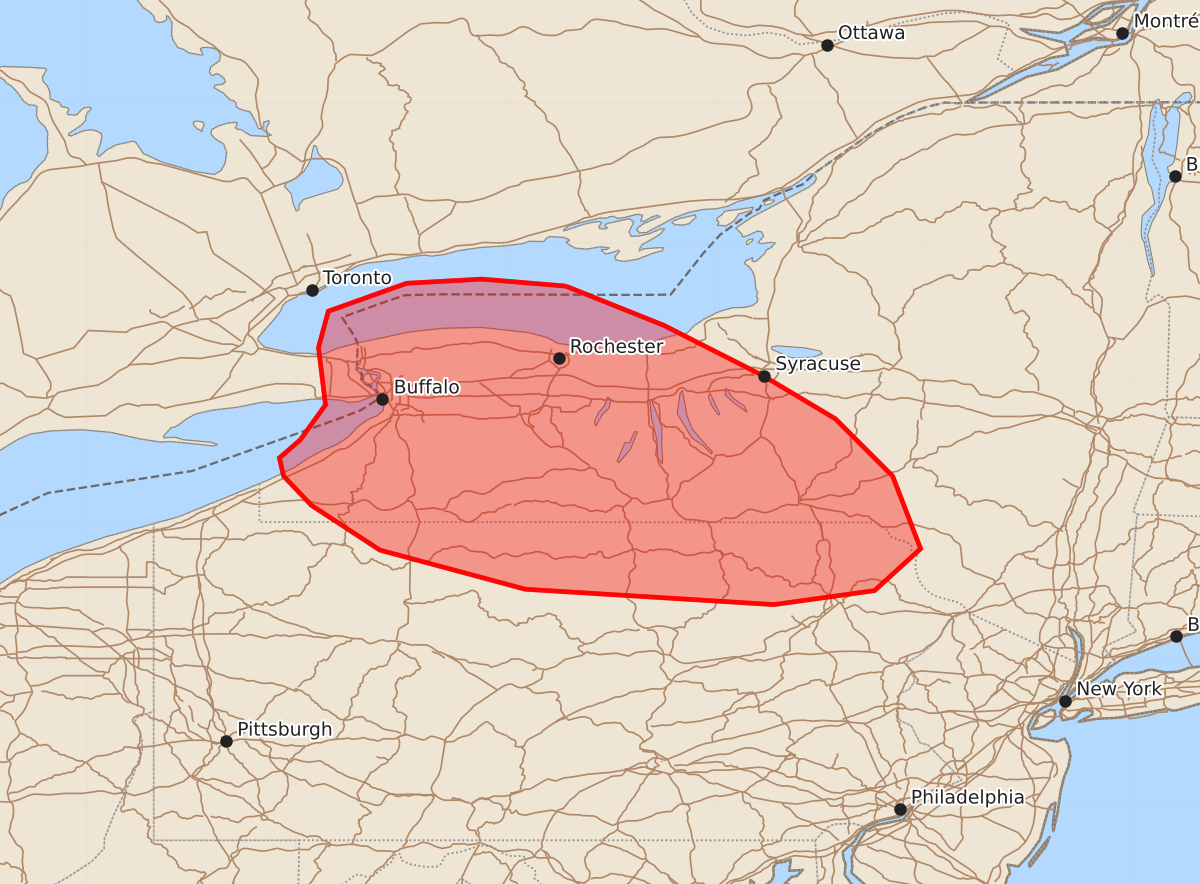
Isolated to widely scattered thunderstorms will bring a risk of large hail and damaging wind gusts to portions of western New York and the Northern Tier of Pennsylvania this afternoon.
Product Text
000 ACUS11 KWNS 121711 SWOMCD SPC MCD 121710 NYZ000-PAZ000-121915- Mesoscale Discussion 1951 NWS Storm Prediction Center Norman OK 1210 PM CDT Wed Aug 12 2026 Areas affected...portions of western New York into the Northern Tier of Pennsylvania Concerning...Severe potential...Watch unlikely Valid 121710Z - 121915Z Probability of Watch Issuance...20 percent SUMMARY...Isolated to widely scattered thunderstorms will pose an isolated risk for large hail and damaging wind gusts this afternoon from the Niagra Frontier into the Northern Tier of PA. DISCUSSION...Isolated to widely scattered thunderstorms are ongoing across southern Ontario and portions of the Niagra Frontier as of 1710 UTC, with this activity forecast to develop southeastward into southern NY/northern PA through this afternoon. While surface temperatures remain seasonably cool in the low-to-mid 70s F, surface dewpoints in the low-to-mid 60s F and regionally steep mid-level lapse rates of 6-7 C/km are supporting modest buoyancy, with 1000 to locally 1500 J/kg MLCAPE indicated by recent objective analysis. Concurrently, a mid/upper-level speed max will continue to shift eastward from Lower Michigan into NY/PA through this afternoon and evening. This enhanced mid/upper flow (sampled by the BUF VAD profile and the 12 UTC BUF observed sounding) will continue to promote effective shear of 30-40 kts and elongated hodographs favorable for supercell structures. The primary risks associated with this activity will be large hail and damaging wind gusts. Current expectations are for convective coverage and the severe risk to remain too isolated for watch issuance; however, a targeted Severe Thunderstorm Watch could be considered should greater storm/severe coverage prevail. ..Chalmers/Thompson.. 08/12/2026 ...Please see www.spc.noaa.gov for graphic product... ATTN...WFO...BGM...BUF...CTP... LAT...LON 43697757 43417687 43057616 42747564 42337523 41817503 41517536 41417608 41527786 41807890 42127939 42337959 42467962 42597947 42847929 43257934 43517927 43717871 43747817 43697757 MOST PROBABLE PEAK TORNADO INTENSITY...UP TO 90 MPH MOST PROBABLE PEAK WIND GUST...UP TO 60 MPH MOST PROBABLE PEAK HAIL SIZE...1.00-1.75 IN