Mesoscale Discussion 1775
Issued: · Valid: –
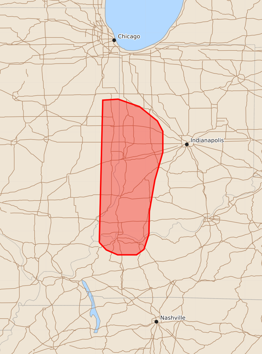
Summary
Severe thunderstorms capable of producing damaging wind gusts and hail will affect portions of eastern Illinois, western Indiana, and northwestern Kentucky through early tonight. The severe weather threat is expected to continue for several more hours.
Product Text
000 ACUS11 KWNS 280009 SWOMCD SPC MCD 280009 INZ000-KYZ000-ILZ000-280145- Mesoscale Discussion 1775 NWS Storm Prediction Center Norman OK 0709 PM CDT Mon Jul 27 2026 Areas affected...portions of far eastern Illinois into western Indiana and far northwestern Kentucky Concerning...Severe Thunderstorm Watch 521... Valid 280009Z - 280145Z The severe weather threat for Severe Thunderstorm Watch 521 continues. SUMMARY...The severe threat should continue for several more hours, with damaging gusts the main threat. Given that Severe Thunderstorm Watch 521 is set to expire at 01Z, a WW time extension or a new Severe Thunderstorm Watch issuance will be needed to cover the longer-term threat. DISCUSSION...Supercells continue to track southward along the western flank of a broader region of convection. MRMS mosaic MESH radar data shows severe hail falling with these storms, several of which containing 30 dBZ echo tops exceeding 50 kft. These storms continue to track southward amid an airmass characterized by 4000 J/kg MLCAPE and 50-60 kts of effective bulk shear. Given the highly favorable ambient parameter space preceding these storms, severe potential should continue for at least a few more hours, which exceeds the expiration time of Severe Thunderstorm Watch 521. Therefore, either a temporal extension of Severe Thunderstorm Watch 521 or a new Severe Thunderstorm Watch issuance will likely be needed in the next hour or so. ..Squitieri/Smith.. 07/28/2026 ...Please see www.spc.noaa.gov for graphic product... ATTN...WFO...LMK...IND...PAH...LOT...ILX... LAT...LON 37778793 40648786 40668755 40518712 40228676 40018665 39598665 39038681 38408692 37948693 37638703 37528718 37528756 37628779 37778793 MOST PROBABLE PEAK TORNADO INTENSITY...UP TO 90 MPH MOST PROBABLE PEAK WIND GUST...55-70 MPH MOST PROBABLE PEAK HAIL SIZE...1.00-1.75 IN