Mesoscale Discussion 1850
Issued: · Valid: –
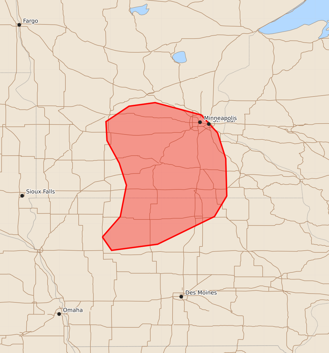
Summary
Severe storms capable of producing large hail may develop across southern Minnesota and northern Iowa through late morning. These storms could produce hail larger than one inch.
Product Text
000 ACUS11 KWNS 071552 SWOMCD SPC MCD 071552 MNZ000-IAZ000-071715- Mesoscale Discussion 1850 NWS Storm Prediction Center Norman OK 1052 AM CDT Fri Aug 07 2026 Areas affected...southern Minnesota into northern Iowa Concerning...Severe potential...Watch unlikely Valid 071552Z - 071715Z Probability of Watch Issuance...20 percent SUMMARY...Over the next several hours, storms may produce hail above severe limits from southern Minnesota into northern Iowa. DISCUSSION...An area of elevated storms has develop this morning over southern MN, with indications of hail. These storms are firmly within a zone of 850 mb theta-e advection out of the southwest, well ahead of the surface cold front. This warming/moistening is also occurring beneath relatively cool midlevel temperatures with -10 C at 500 mb measured on soundings. Given persistent southwest flow at 850 mb and eventual heating of the surface instability plume from NE into IA, these storms may persist for a few more hours, with brief bouts of hail over 1.00". ..Jewell.. 08/07/2026 ...Please see www.spc.noaa.gov for graphic product... ATTN...WFO...ARX...MPX...DMX...FSD... LAT...LON 42749516 43149481 43759469 44189483 44629507 44999509 45299464 45369413 45129323 44779291 44279275 43549273 43149297 42609408 42489498 42749516 MOST PROBABLE PEAK WIND GUST...UP TO 60 MPH MOST PROBABLE PEAK HAIL SIZE...1.00-1.75 IN