Mesoscale Discussion 1834
Issued: · Valid: –
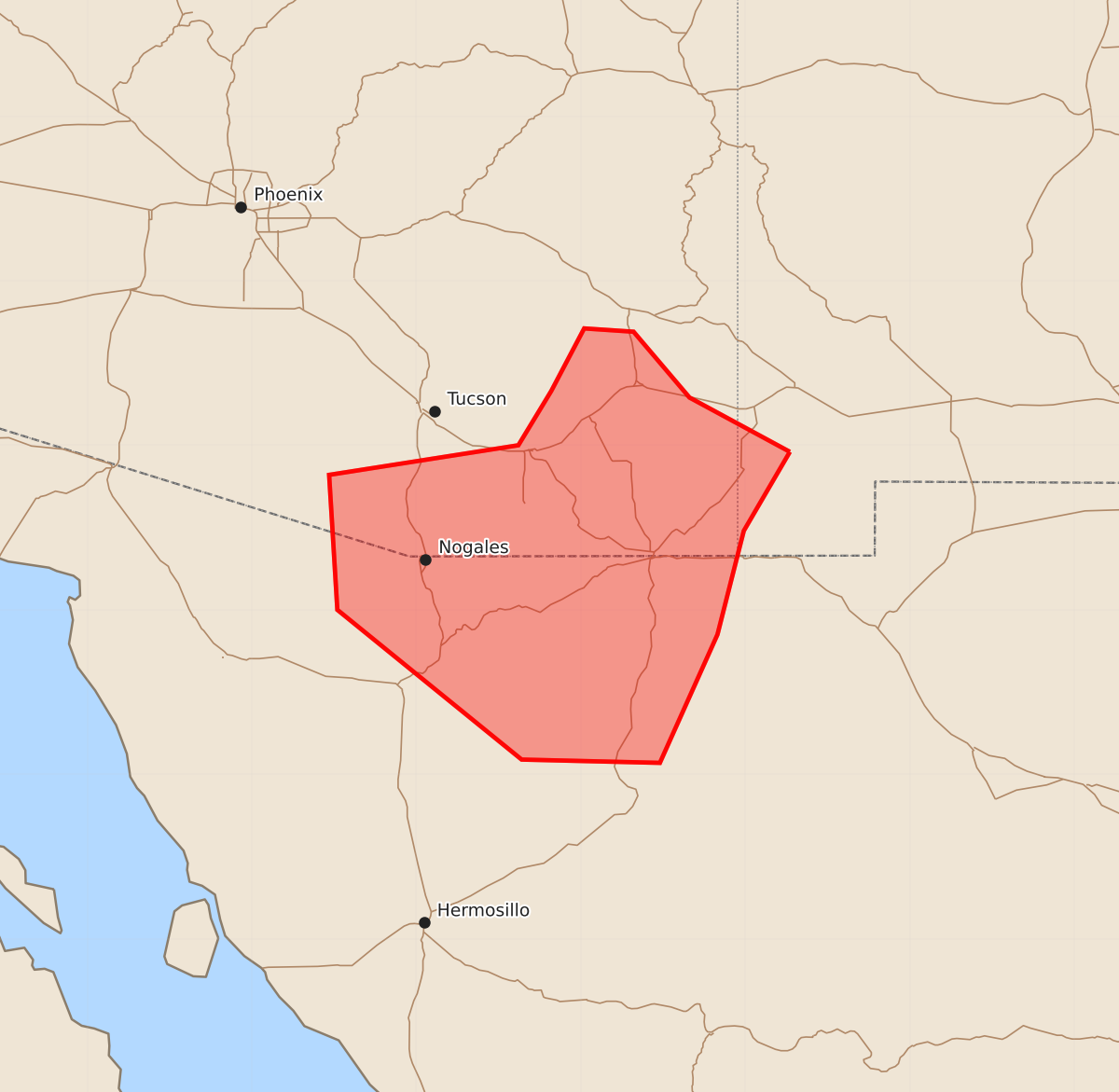
Summary
Severe thunderstorms capable of producing strong wind gusts and hail are expected to increase in southeastern Arizona, particularly east and south of Tucson, through approximately 9 PM MST. These storms may produce wind gusts between 65 and 80 mph and hail up to 1.25 inches.
Product Text
000 ACUS11 KWNS 050051 SWOMCD SPC MCD 050051 NMZ000-AZZ000-050245- Mesoscale Discussion 1834 NWS Storm Prediction Center Norman OK 0751 PM CDT Tue Aug 04 2026 Areas affected...southeastern Arizona Concerning...Severe Thunderstorm Watch 538... Valid 050051Z - 050245Z The severe weather threat for Severe Thunderstorm Watch 538 continues. SUMMARY...Thunderstorm activity appears likely to continue to increase, particularly to the east and south of Tucson, through 7-9 PM MST, accompanied by occasional strong to severe outflow surface gusts. DISCUSSION...Deep-layer mean flow across the southern Arizona/New Mexico state border vicinity and international border remains light and northeasterly, but mid-level flow (around 20 kt near 500 mb) appears a bit stronger with a more prominent easterly component than 24 hours ago. A substantive clustering of storms, which has been propagating slowly westward off the higher terrain to the north and northeast of Safford, has shown notable recent weakening after becoming fairly vigorous. It seems unlikely that it will make it to the lower deserts, where the hot and deeply mixed boundary-layer remains characterized by rather weak instability. However, based on latest mesoanalysis, boundary-layer instability east and south of the the Tucson vicinity may be sufficient to maintain continuing convective development and a southwestward propagation of the southern flank of the cold pool over the next few couple of hours. Later this evening, as outflow emanating from an evolving cluster south of the international border interacts with the outflow approaching from the northeast, there appears potential for increasing thunderstorm development across the international border vicinity near/south of Tucson. If this occurs, it appears that low-level thermodynamic profiles may still be conducive to strong to severe outflow surface gusts. ..Kerr.. 08/05/2026 ...Please see www.spc.noaa.gov for graphic product... ATTN...WFO...EPZ...TWC... LAT...LON 31960873 31480901 30850917 30070952 30091036 31001148 31821153 32001038 32331018 32710998 32690968 32290934 31960873 MOST PROBABLE PEAK WIND GUST...65-80 MPH MOST PROBABLE PEAK HAIL SIZE...UP TO 1.25 IN