Watch 300 Outline
Issued:
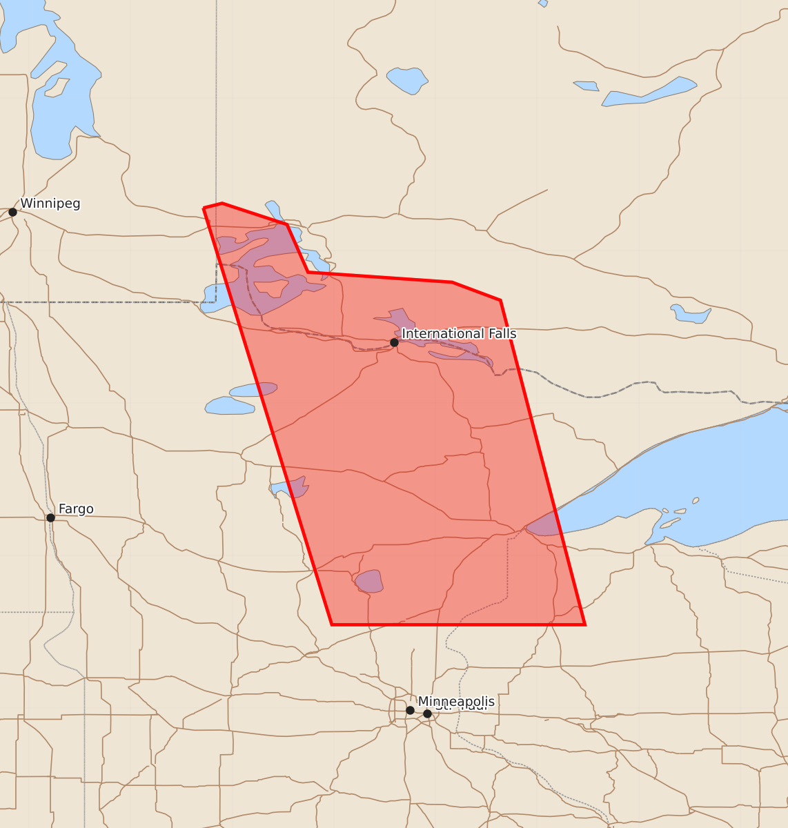
Summary
A severe thunderstorm watch is in effect for portions of Minnesota and Wisconsin, including the areas around Hibbing and Duluth, until approximately 1:00 PM UTC. Expected hazards include 1.5-inch hail and wind gusts up to 60 knots.
Product Text
000 WWUS30 KWNS 100736 SAW0 SPC AWW 100736 WW 300 SEVERE TSTM MN WI LS 100740Z - 101300Z AXIS..60 STATUTE MILES EAST AND WEST OF LINE.. 85NNW HIB/HIBBING MN/ - 75SSW DLH/DULUTH MN/ ..AVIATION COORDS.. 50NM E/W /7WSW INL - 60NNE MSP/ HAIL SURFACE AND ALOFT..1.5 INCHES. WIND GUSTS..60 KNOTS. MAX TOPS TO 500. MEAN STORM MOTION VECTOR 23035. LAT...LON 48519223 45829153 45829402 48519485 THIS IS AN APPROXIMATION TO THE WATCH AREA. FOR A COMPLETE DEPICTION OF THE WATCH SEE WOUS64 KWNS FOR WOU0.