Mesoscale Discussion 2278
Issued: · Valid: –
Summary
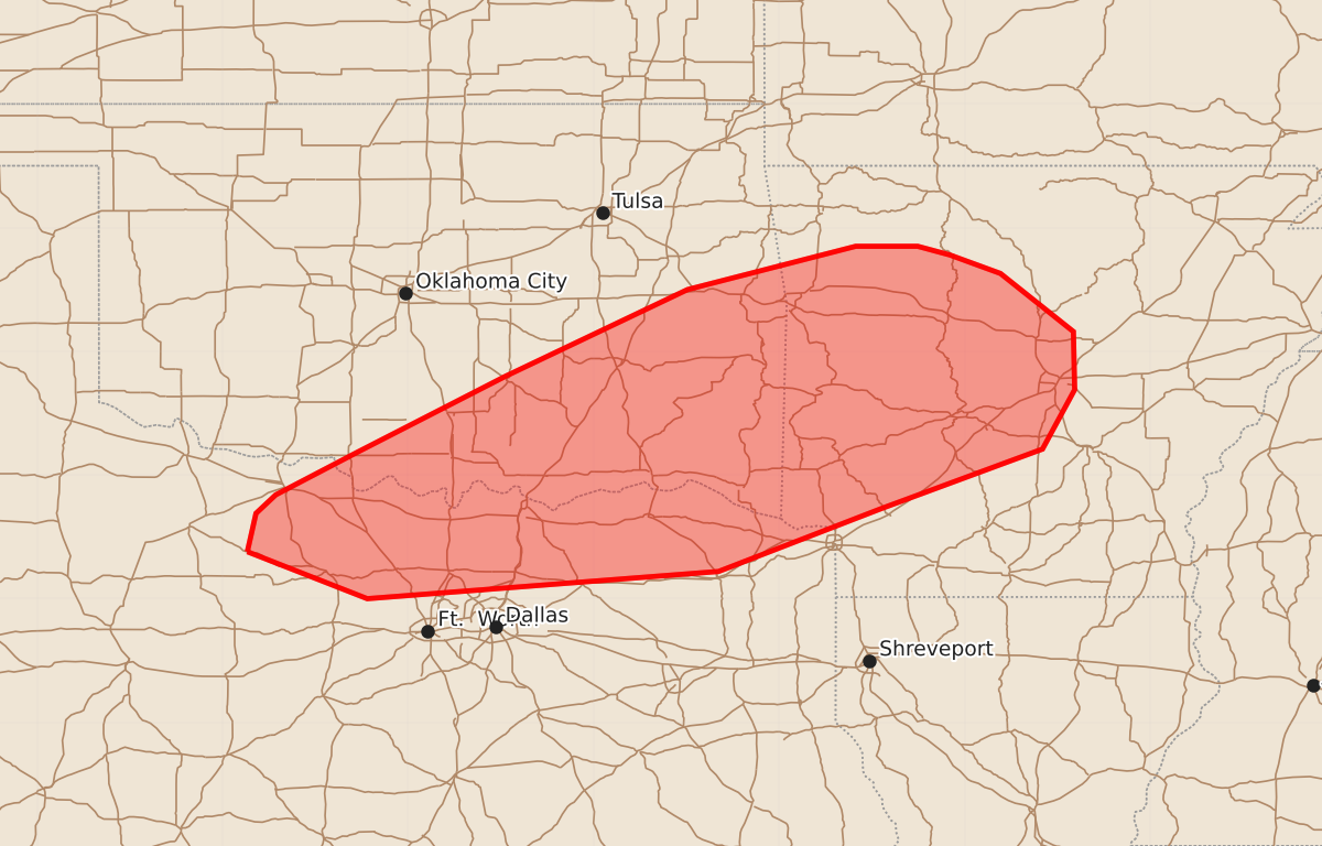
Isolated severe wind gusts are possible this afternoon across portions of southeastern Oklahoma, northern Texas, and western central Arkansas.
Product Text
000 ACUS11 KWNS 101804 SWOMCD SPC MCD 101804 ARZ000-TXZ000-OKZ000-101930- Mesoscale Discussion 2278 NWS Storm Prediction Center Norman OK 0104 PM CDT Thu Sep 10 2026 Areas affected...portions of southeastern Oklahoma into northern Texas and western into central Arkansas Concerning...Severe potential...Watch unlikely Valid 101804Z - 101930Z Probability of Watch Issuance...5 percent SUMMARY...A couple of severe gusts are possible this afternoon. DISCUSSION...Thunderstorms have been gradually intensifying ahead of convective outflow remnant from an earlier complex. This outflow and accompanying convection will continue to propagate south-southeastward into a hot and unstable airmass. Surface temperatures and dewpoints in the mid 90s F/low 70s F are contributing to 1000-2000 J/kg MLCAPE given rich low-level moisture. However, mid-level lapse rates and tropospheric flow are relatively poor. The stronger storm cores will be capable of producing wet downbursts, a couple of which may result in 50+ kt gusts. Nonetheless, given poor thermodynamics/kinematics aloft, the severe threat should remain sparse at best. ..Squitieri/Guyer.. 09/10/2026 ...Please see www.spc.noaa.gov for graphic product... ATTN...WFO...LZK...SHV...TSA...FWD...OUN... LAT...LON 33389880 33699873 33849857 34199790 34809671 35509524 35859388 35859338 35789312 35639271 35169212 34699211 34219237 33739367 33229499 33009783 33389880 MOST PROBABLE PEAK WIND GUST...UP TO 60 MPH