Mesoscale Discussion 2165
Issued: · Valid: –
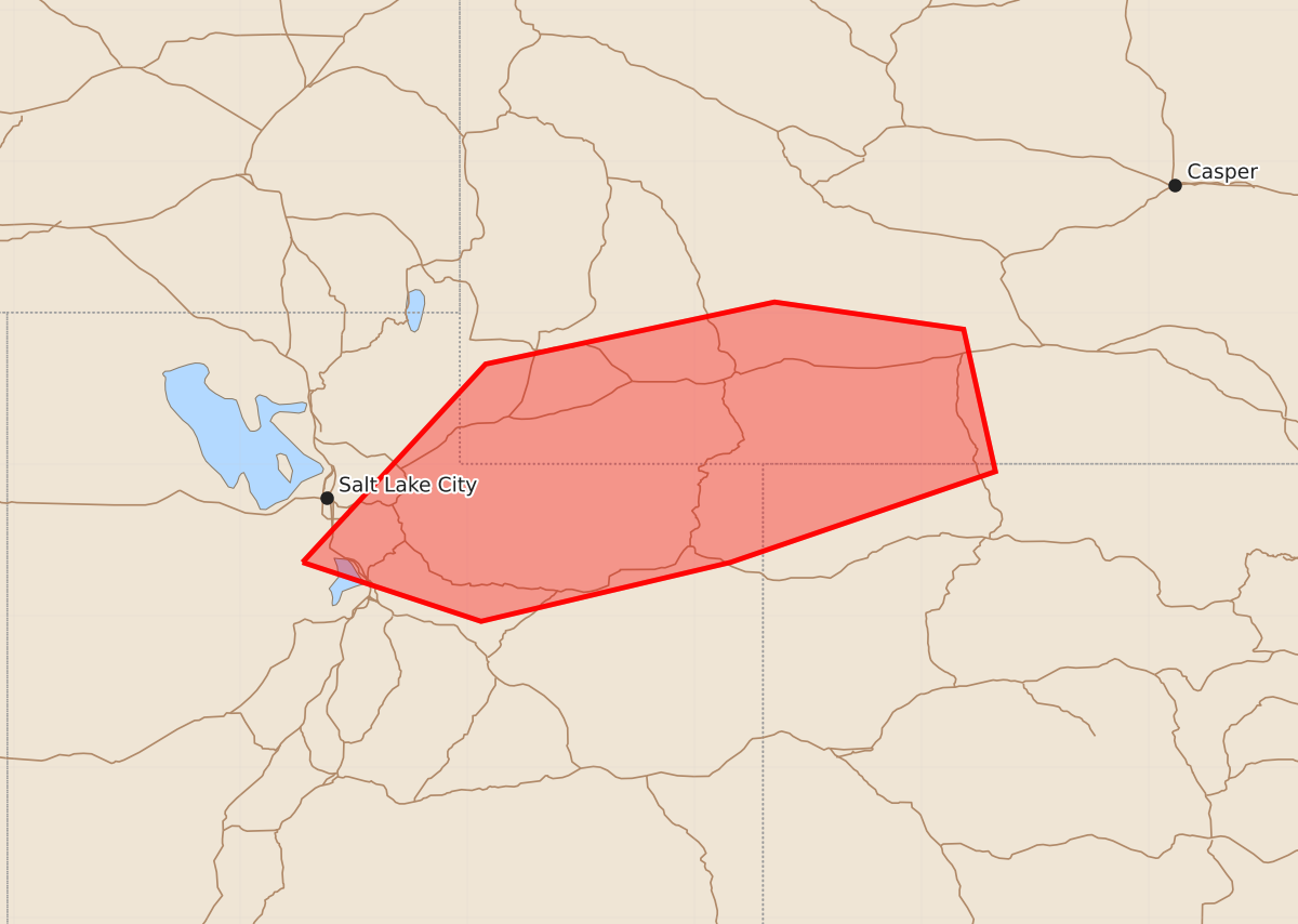
Summary
Thunderstorms are expected to develop across parts of northeastern Utah, southwestern and south central Wyoming, and northwestern Colorado through 3 PM MDT, bringing a potential for strong wind gusts and small hail.
Product Text
000 ACUS11 KWNS 291732 SWOMCD SPC MCD 291731 WYZ000-COZ000-UTZ000-292000- Mesoscale Discussion 2165 NWS Storm Prediction Center Norman OK 1231 PM CDT Sat Aug 29 2026 Areas affected...parts of northeastern Utah...southwestern/south central Wyoming...northwestern Colorado Concerning...Severe potential...Watch unlikely Valid 291731Z - 292000Z Probability of Watch Issuance...20 percent SUMMARY...Thunderstorms are likely to continue developing and overspreading the region through 1-3 PM MDT, accompanied by gradually increasing potential to produce strong to severe wind gusts and small hail. It is still not clear that this will require a severe weather watch, but trends will be monitored. DISCUSSION...Downstream of a low-amplitude short wave trough, a corridor of strengthening frontogenetic forcing for ascent (around and below 700 mb) has provided the primary focus for thunderstorm development the past few hours. This forcing is forecast to continue to shift east-northeastward into/across the southwestern through south central Wyoming state border vicinity through 21-22Z. The environment along the baroclinic zone is relatively moist, but with a still relatively cool boundary layer and weak to modest low/mid-level lapse rates limiting destabilization. Even so, shear beneath moderate to strong westerly mid/upper flow, including speeds of 40-50 kt within the lowest 3-4 km AGL, has been sufficient to support at least one longer-lived vigorous cell with strong to severe gusts and marginally severe hail southwest through south of the Great Salt Lake this morning. Similar strength convection appears possible over the next few hours, east of the Wasatch, along the Uinta Mountains through the western Colorado/Wyoming border vicinity, where ongoing insolation is contributing to the evolution of an increasingly deeply mixed boundary layer. Forecast soundings suggest that profiles in lower elevations may become characterized by 30-40 F surface temperature/dew point spreads, with CAPE exceeding 500 J/kg. As this occurs, the environment may become conducive to increasing thunderstorm development with strengthening downdrafts aiding the downward transport of strong to severe gusts to the surface. ..Kerr/Mosier.. 08/29/2026 ...Please see www.spc.noaa.gov for graphic product... ATTN...WFO...CYS...RIW...GJT...SLC... LAT...LON 40351209 41661088 42070897 41890772 40950751 40350926 39961091 40351209 MOST PROBABLE PEAK WIND GUST...55-70 MPH MOST PROBABLE PEAK HAIL SIZE...UP TO 1.25 IN