Mesoscale Discussion 1429
Issued: · Valid: –
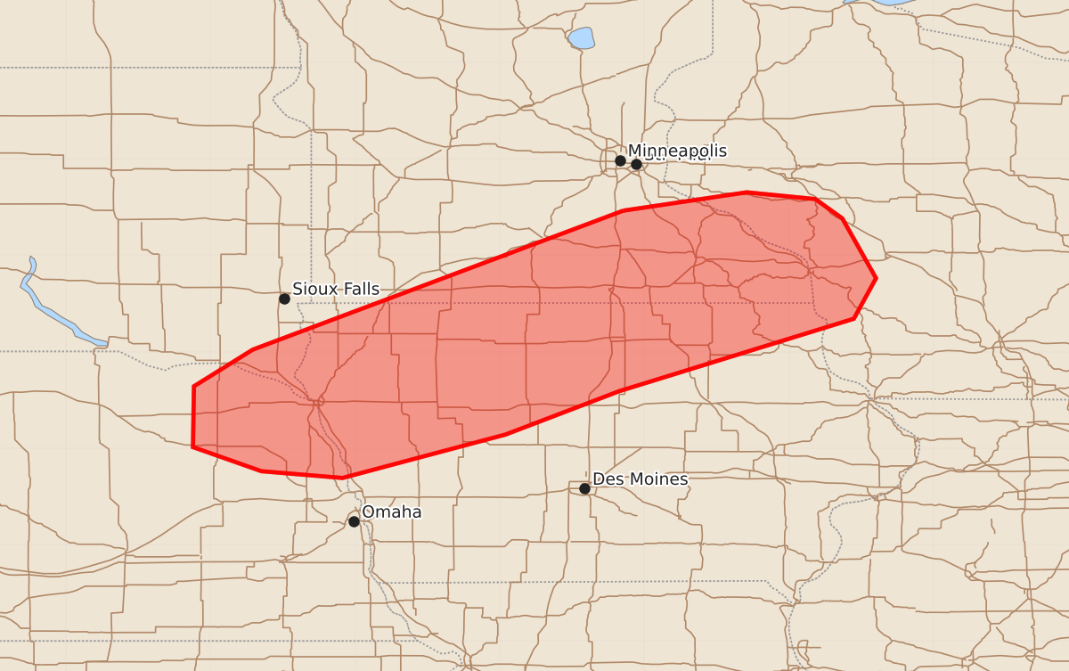
Summary
Severe thunderstorms capable of producing damaging winds, large hail, and tornadoes are expected across northeast Nebraska, northern Iowa, southern Minnesota, western Wisconsin, and far southeast South Dakota this evening.
Product Text
000 ACUS11 KWNS 012311 SWOMCD SPC MCD 012311 WIZ000-IAZ000-MNZ000-NEZ000-SDZ000-020115- Mesoscale Discussion 1429 NWS Storm Prediction Center Norman OK 0611 PM CDT Wed Jul 01 2026 Areas affected...Northeast NE...northern IA...southern MN...western WI...and far southeast SD Concerning...Severe potential...Watch likely Valid 012311Z - 020115Z Probability of Watch Issuance...80 percent SUMMARY...The area is being monitored for thunderstorm development and an increasing all-hazards severe risk. While timing/evolution of the severe risk remains uncertain, current thinking is that a watch will be needed. DISCUSSION...The latest visible satellite imagery indicates a ENE/WSW-oriented band of gradually deepening boundary-layer cumulus along a subtle surface boundary/confluence zone extending from southern MN into northwest IA and vicinity. Over the next couple hours, a strengthening southerly LLJ and related isentropic lift should reduce remaining inhibition (sampled by the OAX 18Z sounding) and promote widely scattered thunderstorm development along/near the boundary. A warm/moist PBL (lower/middle 70s dewpoints) beneath steep lapse rates is yielding strong surface-based buoyancy, which combined with around 40 kt of effective shear, will favor storm organization/intensification. Given the increasing warm advection and boundary-parallel deep-layer shear, a mixed mode of supercells and organized clusters will pose a risk for severe/damaging wind gusts, large hail, and a couple tornadoes (given increasing clockwise-curved low-level hodographs). While the subtle forcing for ascent casts uncertainty on overall convective timing/evolution, current thinking is that a watch will be needed for parts of the area. ..Weinman/Thompson.. 07/01/2026 ...Please see www.spc.noaa.gov for graphic product... ATTN...WFO...ARX...MPX...DMX...FSD...OAX... LAT...LON 44469322 44659194 44589123 44389095 43769060 43349083 42599326 42149444 41699613 41769697 42019768 42649767 43029706 44469322 MOST PROBABLE PEAK TORNADO INTENSITY...85-110 MPH MOST PROBABLE PEAK WIND GUST...65-80 MPH MOST PROBABLE PEAK HAIL SIZE...1.50-2.50 IN