Day 2 Convective Outlook
Issued: · Valid: –
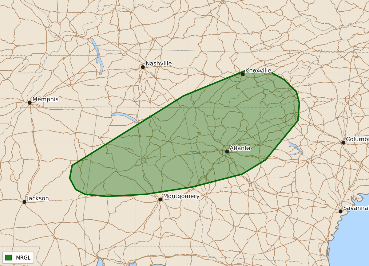
Summary
Isolated damaging wind gusts from severe thunderstorms are possible across parts of the Southeast on Tuesday.
Product Text
000 ACUS02 KWNS 211656 SWODY2 SPC AC 211655 Day 2 Convective Outlook NWS Storm Prediction Center Norman OK 1155 AM CDT Mon Sep 21 2026 Valid 221200Z - 231200Z ...THERE IS A MARGINAL RISK OF SEVERE THUNDERSTORMS ACROSS PARTS OF THE SOUTHEAST... ...SUMMARY... Isolated damaging gusts are possible over parts of the Southeast on Tuesday. ...Southeast... A weak mid/upper shortwave trough will migrate across the Midwest on Tuesday, bringing modest westerly flow aloft across portions of the central and eastern U.S. At the surface, a cold front will sink southward across the Lower MS and TN Valleys into the Carolinas. Mid 60s to lower 70s F dewpoints will be in place ahead of the front, promoting 1500-2500 J/kg MLCAPE amid stronger heating from parts of MS/AL into the southern Appalachians. Midlevel lapse rates and effective shear magnitudes will remain weak, but where stronger heating occurs, steepened low-level lapse rates amid 1.75-2 inch PW values are expected. This could support sporadic strong wind gusts within wet microbursts. Overall, severe potential should remain limited. ..Leitman.. 09/21/2026 $$