Mesoscale Discussion 1233
Issued: · Valid: –
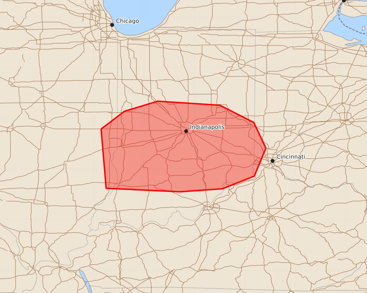
Summary
An increasing tornado threat is expected across southern and central Indiana this evening as thunderstorms move into the area. These storms may produce significant tornadoes with winds up to 125 mph, wind gusts up to 80 mph, and hail up to 1.25 inches.
Product Text
000 ACUS11 KWNS 212124 SWOMCD SPC MCD 212123 OHZ000-KYZ000-INZ000-ILZ000-212300- Mesoscale Discussion 1233 NWS Storm Prediction Center Norman OK 0423 PM CDT Sun Jun 21 2026 Areas affected...Southern and Central Indiana Concerning...Severe potential...Watch needed soon Valid 212123Z - 212300Z Probability of Watch Issuance...95 percent SUMMARY...The tornado threat is increasing across portions of southern Indiana as thunderstorms with a history of producing tornadoes across southern Illinois move east into the area. A tornado watch will be needed soon. DISCUSSION...Several supercells with a history of producing tornadoes have developed this afternoon across portions of southern Illinois in association with a convectively augmented vorticity maximum moving east within zonal mid-level flow. Ahead of these supercells, a surface boundary is slowly lifting northward across portions of Indiana. To the south of this boundary, surface dewpoints have risen into the 60Fs to low 70Fs contributing to MLCAPE values between 500-1000 J/kg. Along the boundary easterly low-level flow will maximize storm-relative helicity, as indicated by the Indianapolis VAD (KIND) which suggests around 300 m2/s2. The result will be a continued tornado threat this evening across portions of southern and central Indiana and a tornado watch will be required soon. ..Marsh/Smith.. 06/21/2026 ...Please see www.spc.noaa.gov for graphic product... ATTN...WFO...ILN...LMK...IND...ILX... LAT...LON 39798785 40148739 40348673 40268550 39928483 39418459 38868482 38618545 38558629 38628775 39798785 MOST PROBABLE PEAK TORNADO INTENSITY...100-125 MPH MOST PROBABLE PEAK WIND GUST...65-80 MPH MOST PROBABLE PEAK HAIL SIZE...UP TO 1.25 IN