Mesoscale Discussion 1657
Issued: · Valid: –
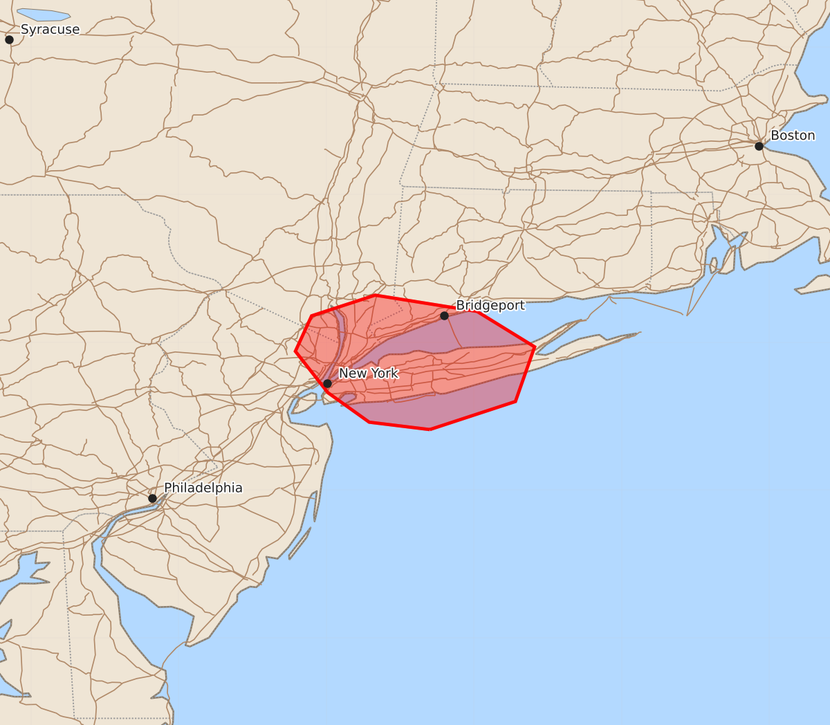
Summary
An eastward-moving band of thunderstorms may produce strong to damaging wind gusts across parts of southeast New York, Long Island, and far southwest Connecticut through approximately 7:45 PM CDT. These localized storms are expected to bring wind gusts between 55 and 70 mph over the next hour.
Product Text
000 ACUS11 KWNS 182346 SWOMCD SPC MCD 182346 NYZ000-CTZ000-NJZ000-190045- Mesoscale Discussion 1657 NWS Storm Prediction Center Norman OK 0646 PM CDT Sat Jul 18 2026 Areas affected...Parts of southeast NY...Long Island...and far southwest CT Concerning...Severe potential...Watch unlikely Valid 182346Z - 190045Z Probability of Watch Issuance...20 percent SUMMARY...An eastward-moving band of thunderstorms will pose a localized risk of strong to damaging wind gusts for the next hour or so. DISCUSSION...A loosely organized band or thunderstorms is tracking eastward into Long Island. The KOKX VWP is sampling around 45 kt of line-orthogonal 0-6 km shear, which may continue to support an organized cold pool as it continues eastward, despite marginal buoyancy. Given the established cold pool, 30-40 kt of flow in the lowest 2 km, and at least neutral static stability in the boundary layer, strong to locally damaging wind gusts will be possible over the next hour or so. The overall severe risk is expected to remain too localized/marginal for a watch. ..Weinman/Hart.. 07/18/2026 ...Please see www.spc.noaa.gov for graphic product... ATTN...WFO...OKX... LAT...LON 40417330 40467371 40667399 40947421 41187410 41327367 41217298 40977259 40607272 40417330 MOST PROBABLE PEAK TORNADO INTENSITY...UP TO 90 MPH MOST PROBABLE PEAK WIND GUST...55-70 MPH MOST PROBABLE PEAK HAIL SIZE...UP TO 1.25 IN