Mesoscale Discussion 2282
Issued: · Valid: –
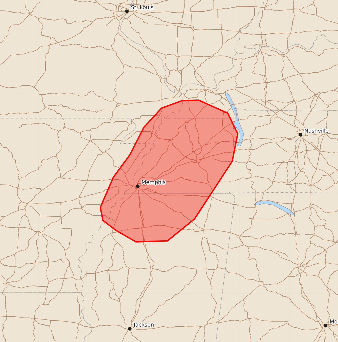
Summary
Isolated thunderstorms may develop across parts of the Mid-South through this evening, potentially producing locally damaging wind gusts between 55 and 70 mph.
Product Text
000 ACUS11 KWNS 112024 SWOMCD SPC MCD 112024 TNZ000-KYZ000-MSZ000-MOZ000-ARZ000-112300- Mesoscale Discussion 2282 NWS Storm Prediction Center Norman OK 0324 PM CDT Fri Sep 11 2026 Areas affected...Parts of the Mid-South Concerning...Severe potential...Watch unlikely Valid 112024Z - 112300Z Probability of Watch Issuance...20 percent SUMMARY...Thunderstorms should gradually increase in coverage through the remainder of the afternoon into this evening. The strongest storms will be capable of producing a few locally damaging wind gusts. DISCUSSION...Preceding a convectively augmented midlevel trough moving slowly eastward across the Ozarks, isolated thunderstorms are evolving along a north/south-oriented composite outflow/stationary boundary in far eastern AR. Ahead of this activity, continued diurnal heating amid lower 70s dewpoints will further destabilize the pre-convective air mass, though overall buoyancy will be limited by poor midlevel lapse rates. Nevertheless, the relatively focused area of forcing for ascent and weakly veering wind profile accompanying/trailing a remnant MCV could promote a few strong storms over the next few hours. The primary concern will be locally damaging wind gusts with any loosely organized clusters that develop through this evening. ..Weinman/Guyer.. 09/11/2026 ...Please see www.spc.noaa.gov for graphic product... ATTN...WFO...PAH...MEG... LAT...LON 35329051 35779018 36328990 36708955 36858914 36868881 36608823 36198803 35648814 34498889 34058943 34039006 34269046 34469072 34729077 35329051 MOST PROBABLE PEAK WIND GUST...55-70 MPH