Mesoscale Discussion 1255
Issued: · Valid: –
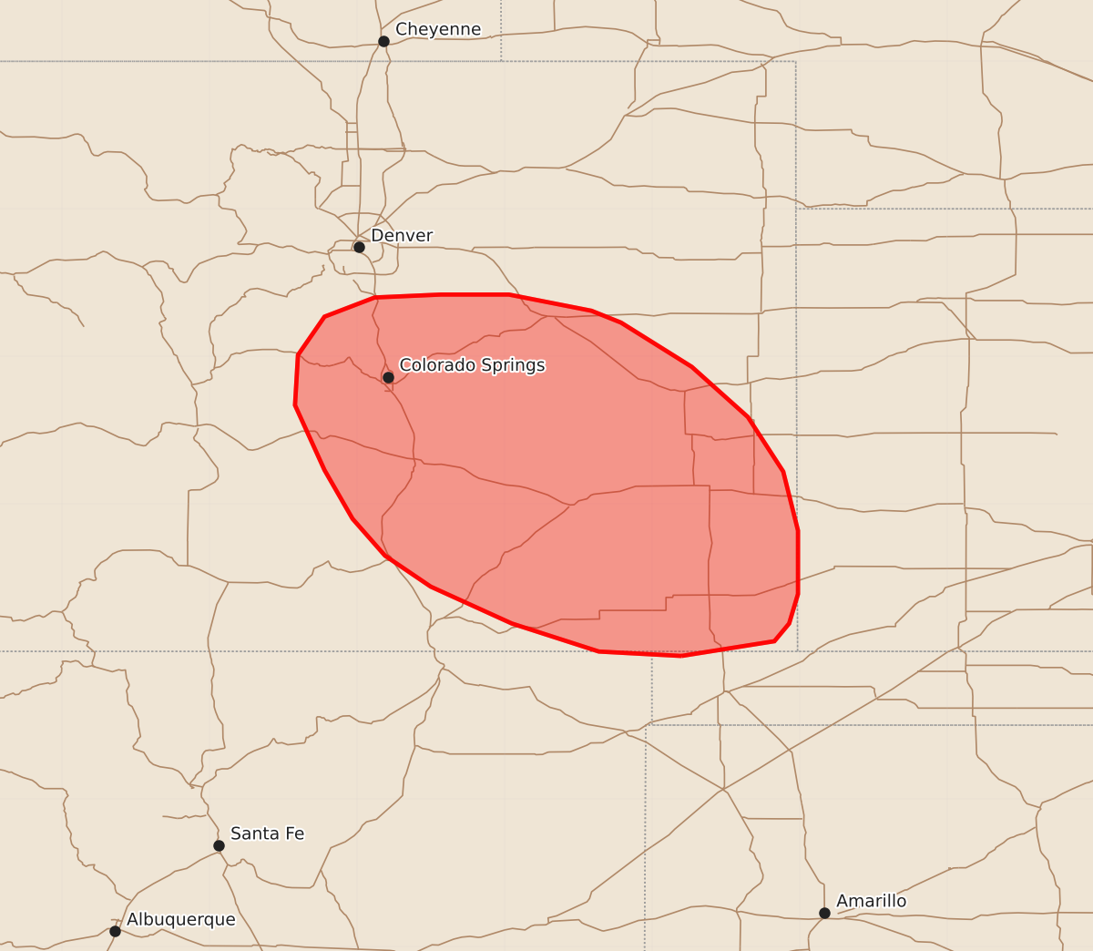
Summary
Severe thunderstorms capable of producing large hail and strong winds are expected to develop along the Colorado Front Range and spread east/southeast this afternoon. These storms may include supercells capable of producing very large hail and wind gusts up to 70 mph.
Product Text
000 ACUS11 KWNS 221841 SWOMCD SPC MCD 221840 KSZ000-OKZ000-COZ000-NMZ000-222045- Mesoscale Discussion 1255 NWS Storm Prediction Center Norman OK 0140 PM CDT Mon Jun 22 2026 Areas affected...East-central to southeast Colorado Concerning...Severe potential...Watch likely Valid 221840Z - 222045Z Probability of Watch Issuance...80 percent SUMMARY...Thunderstorm development appears likely along the Front Range from central to southern Colorado in the next 1-2 hours. Watch issuance is likely as storms develop and spread east/southeast. DISCUSSION...Latest GOES imagery depicts growing cumulus from the Denver area southward along the Front Range and into the Raton Mesa within a weak upslope flow regime. This comes as temperatures begin to warm into the low to mid 80s, which latest CAM guidance suggests is required to erode mixed-layer inhibition and support convective initiation. Based on these satellite and temperature trends, deep convective initiation appears probable within the next 1-2 hours. Initially high-based convection will quickly spread east/southeast given the 30-40 knot west/northwest flow regime aloft. Steady intensification with eastward extent is expected as storms migrate into the axis of rich low-level moisture (dewpoints in the upper 50s to low 60s) in place along the eastern Plains. Additionally, elongated hodographs featuring 40-50 knots of effective bulk shear analyzed in recent mesoanalyses/forecast soundings (and confirmed by regional VWPs) will promote splitting supercells capable of large to very large hail (possibly as high as 2-3 inches) as well as strong outflow winds. Watch issuance will be needed this afternoon as initiation becomes more imminent and storms begin to mature. ..Moore/Hart.. 06/22/2026 ...Please see www.spc.noaa.gov for graphic product... ATTN...WFO...DDC...GLD...AMA...PUB...BOU...ABQ... LAT...LON 36970280 37000336 37190395 37440450 37650481 37900503 38230522 38670542 39010540 39270522 39400488 39420443 39420397 39310341 39230321 38930273 38590235 38220211 37820201 37390201 37190207 37070217 36970280 MOST PROBABLE PEAK TORNADO INTENSITY...UP TO 90 MPH MOST PROBABLE PEAK WIND GUST...55-70 MPH MOST PROBABLE PEAK HAIL SIZE...2.00-3.50 IN