Mesoscale Discussion 1117
Issued: · Valid: –
Summary
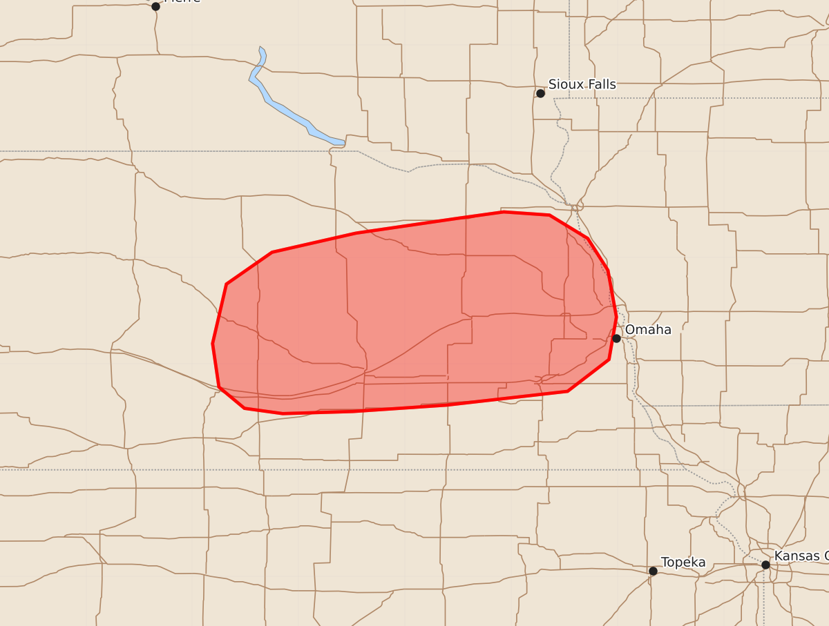
Large hail is expected to develop across parts of central and eastern Nebraska during the early morning hours of Saturday, June 13. The potential severity includes supercells capable of producing hailstones over 2 inches in diameter.
Product Text
000 ACUS11 KWNS 130830 SWOMCD SPC MCD 130830 IAZ000-NEZ000-131100- Mesoscale Discussion 1117 NWS Storm Prediction Center Norman OK 0330 AM CDT Sat Jun 13 2026 Areas affected...Central and Eastern Nebraska Concerning...Severe potential...Watch possible Valid 130830Z - 131100Z Probability of Watch Issuance...40 percent SUMMARY...A threat for large hail is expected to develop across parts of central and eastern Nebraska over the next couple of hours. Weather watch issuance may be needed. DISCUSSION...A mid-level shortwave trough is evident on water vapor imagery over the central High Plains. Ahead of the trough, an axis of maximized low-level moisture is analyzed diagonally across Kansas from southeast to northwest. The RAP has MUCAPE along and to the north of this axis in the 3000 to 4000 J/kg range. As the trough moves into the central Plains over the next few hours, the instability max currently over far northern Kansas will shift northeastward into central and eastern Nebraska, where scattered thunderstorms are expected to initiate. RAP forecast soundings near the instability max have a capping inversion in the low-levels, with effective shear near 45 knots and 700-500 mb lapse rates around 8 C/km. This environment will support a large hail threat with elevated supercells that develop early this morning. If a supercell can become dominant, then hailstones over 2 inches in diameter will be possible. ..Broyles/Guyer.. 06/13/2026 ...Please see www.spc.noaa.gov for graphic product... ATTN...WFO...FSD...OAX...GID...LBF... LAT...LON 42239846 42059925 41759968 41199981 40789975 40589951 40539915 40559849 40619761 40749647 41049608 41449601 41889609 42189628 42409664 42439707 42379750 42239846 MOST PROBABLE PEAK HAIL SIZE...1.50-2.50 IN