Day 4-8 Convective Outlook
Issued: · Valid: –
Summary
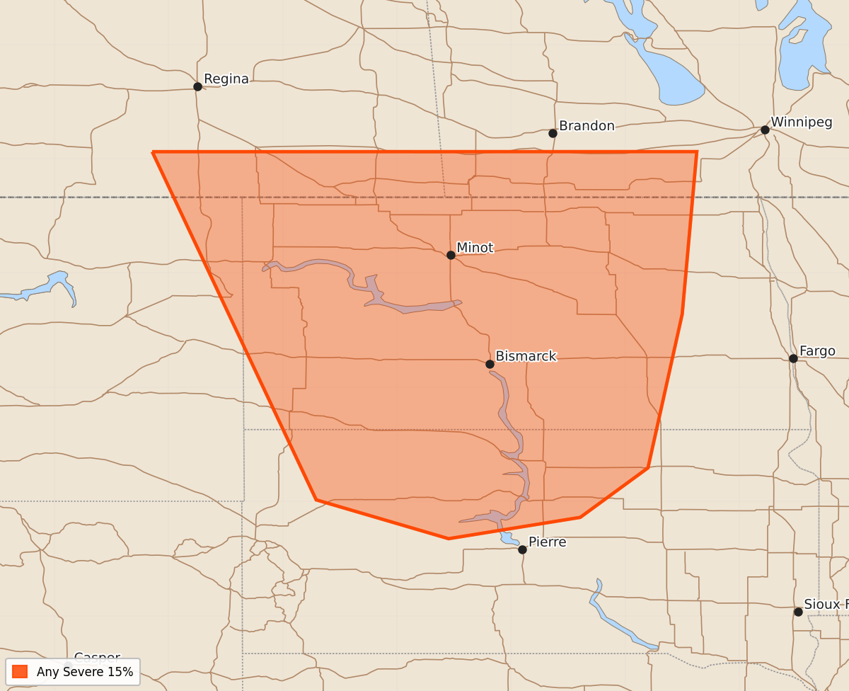
Severe thunderstorms are possible across the western Dakotas on Saturday afternoon and evening.
Product Text
000 ACUS48 KWNS 240844 SWOD48 SPC AC 240842 Day 4-8 Convective Outlook NWS Storm Prediction Center Norman OK 0342 AM CDT Wed Jun 24 2026 Valid 271200Z - 021200Z ...DISCUSSION... ...D4/Saturday - Northern Plains... A strong trough will advance into the Northwest CONUS on Saturday with a strong mid-level jet extending from the Great Basin to the northern Plains. A lee cyclone will develop across eastern Wyoming into western South Dakota. Southerly flow will strengthen and advect low to mid 60s dewpoints northward. This will lead to strong instability by the late afternoon across the western Dakotas. There is still some uncertainty with the evolution of the upper-level trough which will have some impact in the timing and location of the severe weather threat on Saturday. At this time, have confined the 15% area to where the greatest severe weather threat appears likely Saturday afternoon/evening, but this area may need to be refined in future outlooks. ...Day 5 and Beyond... Severe weather will be possible across portions of the Northern Plains into the Upper Midwest Sunday and into next week. However, predictability remains too low to highlight areas in this timeframe. The presence of strong to very strong instability across a large region with multiple shortwave troughs emerging from the primary trough centered over the West will surely support severe weather potential most days. However, probabilities for specific areas cannot be added until the upper-level pattern becomes more clear. ..Bentley.. 06/24/2026