Mesoscale Discussion 1276
Issued: · Valid: –
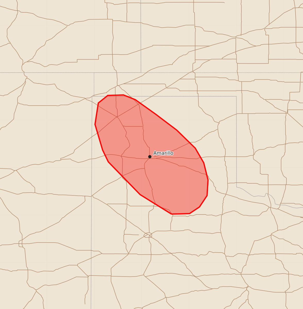
Summary
Severe thunderstorms capable of producing large hail, damaging winds, and possible tornadoes are being monitored for development across the Texas Panhandle during the late afternoon and early evening.
Product Text
000 ACUS11 KWNS 231906 SWOMCD SPC MCD 231906 TXZ000-OKZ000-232100- Mesoscale Discussion 1276 NWS Storm Prediction Center Norman OK 0206 PM CDT Tue Jun 23 2026 Areas affected...Texas Panhandle Concerning...Severe potential...Watch likely Valid 231906Z - 232100Z Probability of Watch Issuance...80 percent SUMMARY...Conditions are being monitored for convective initiation along an outflow boundary across the Texas Panhandle. If/when thunderstorms develop, they will mature within a favorable environment for supercells capable of large/very large hail, severe wind, and perhaps a tornado. DISCUSSION...Latest GOES day cloud phase imagery shows steady vertical growth of cumulus along an outflow boundary migrating west/southwest across the TX Panhandle. A recent 18 UTC RAOB from Amarillo, TX (just ahead of the boundary) sampled a highly buoyant environment (MLCAPE of 3000 J/kg) with adequate deep-layer wind shear (around 37 knots of effective bulk shear) for supercells. Nearly 300 m2/s2 0-3 km SRH sampled by the sounding also strongly suggests supercells will be favored, especially given the relatively weak ascent and some residual capping in the vicinity of the boundary. Consequently, large hail (possibly up to 2.5 inches) appears possible along with severe gusts. With temperatures recovering into the upper 70s on the cool side of the boundary, convection may be able to utilize the slightly stronger 0-1 km SRH along/north of the boundary, which could support some tornado threat. The primary uncertainty is precisely when mature convection will emerge along the boundary. Continued westward progression of the boundary has recently displaced incipient updrafts away from the zone of ascent, suggesting further stalling of the boundary may be required before sustained thunderstorm development occurs. Nonetheless, recent high-res guidance has consistently shown convection developing along this boundary during the late afternoon/early evening hours. Watch issuance will likely be needed once sustained deep convection becomes apparent. ..Moore/Guyer.. 06/23/2026 ...Please see www.spc.noaa.gov for graphic product... ATTN...WFO...LUB...AMA... LAT...LON 34020137 34430203 35120270 35370282 35910298 36360291 36520271 36530238 36430213 36130171 35790126 35410087 35100069 34740060 34410062 34170078 34030099 34020137 MOST PROBABLE PEAK TORNADO INTENSITY...UP TO 90 MPH MOST PROBABLE PEAK WIND GUST...65-80 MPH MOST PROBABLE PEAK HAIL SIZE...1.50-2.50 IN