Mesoscale Discussion 1166
Issued: · Valid: –
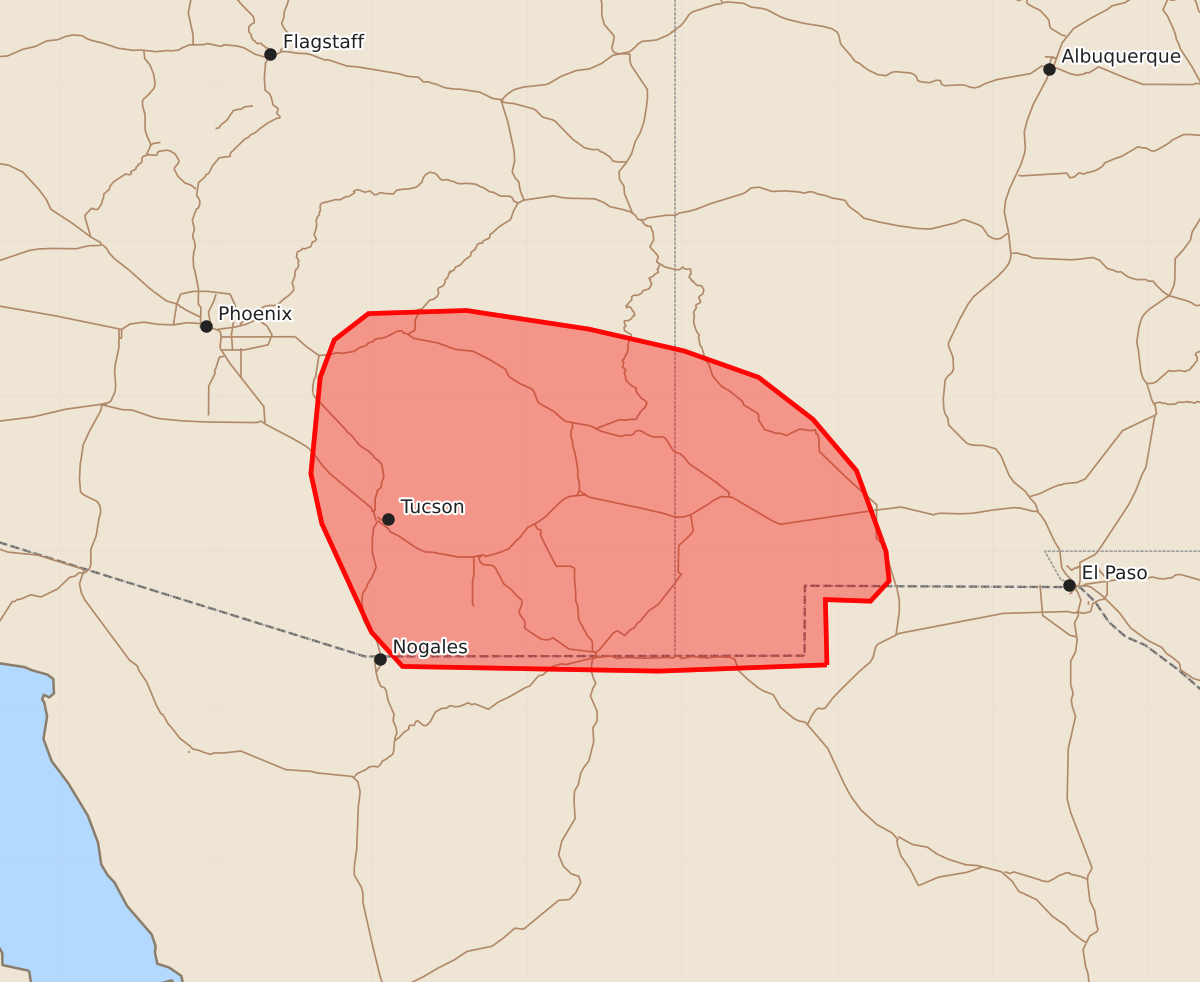
Summary
Scattered thunderstorms producing isolated severe wind gusts are expected across portions of southeastern Arizona and southwestern New Mexico this afternoon and evening. Expected peak wind gusts may reach 55 to 70 mph.
Product Text
000 ACUS11 KWNS 171917 SWOMCD SPC MCD 171916 NMZ000-AZZ000-172115- Mesoscale Discussion 1166 NWS Storm Prediction Center Norman OK 0216 PM CDT Wed Jun 17 2026 Areas affected...portions of southeastern Arizona and southwestern New Mexico Concerning...Severe potential...Watch unlikely Valid 171916Z - 172115Z Probability of Watch Issuance...5 percent SUMMARY...Scattered thunderstorm development is expected this afternoon, with an associated risk for isolated damaging/severe wind gusts. Watch issuance is not anticipated. DISCUSSION...Latest surface observations indicate temperatures have warmed into the mid/upper 90s F with dewpoints ranging from the mid-40s to low-50s across portions of the Southwest (as of 19 UTC). Modifying the 18z EPZ observed sounding for these conditions, a deep, increasingly well-mixed boundary layer extending to near 500 mb is evident, with low- and mid-level lapse rates exceeding 9-9.5 C/km and LCLs of 3.5+ km. As continued insolation results in convective temperatures being breached, scattered, high-based thunderstorms development will occur over the next 1-3 hours. While weak mid-level flow and effective shear will limit storm organization, inverted-v thermodynamic profiles will support efficient evaporative cooling and a risk for isolated damaging/severe wind gusts through this evening. Watch issuance is not expected at this time owing to the isolated nature of the severe threat. ..Chalmers/Hart.. 06/17/2026 ...Please see www.spc.noaa.gov for graphic product... ATTN...WFO...ABQ...EPZ...TWC...PSR... LAT...LON 31270807 31230915 31261080 31481100 32181132 32501139 33121133 33361124 33531102 33551039 33430960 33290899 33120851 32850816 32520788 32000769 31810767 31680779 31690808 31270807 MOST PROBABLE PEAK WIND GUST...55-70 MPH