Mesoscale Discussion 1202
Issued: · Valid: –
Summary
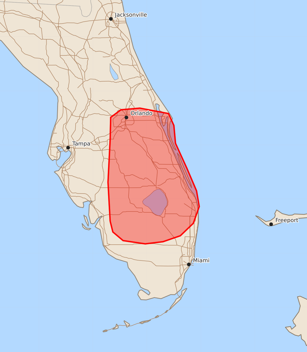
Isolated strong to severe downbursts capable of producing wind gusts up to 60 mph may occur across the central Florida Peninsula this afternoon and early evening.
Product Text
000 ACUS11 KWNS 191932 SWOMCD SPC MCD 191931 FLZ000-192130- Mesoscale Discussion 1202 NWS Storm Prediction Center Norman OK 0231 PM CDT Fri Jun 19 2026 Areas affected...Central Florida Concerning...Severe potential...Watch unlikely Valid 191931Z - 192130Z Probability of Watch Issuance...20 percent SUMMARY...A strong to severe downburst or two may occur across the central Florida Peninsula this afternoon. This threat will likely remain too isolated and transient to warrant watch issuance. DISCUSSION...The early stages of convective development are well underway across the central FL Peninsula amid a combination of strong diurnal heating and weak low-level ascent along a confluence axis draped across the state. Recent surface observations show temperatures have warmed into the low to mid 90s with dewpoints remaining in the mid 70s. This is supporting a regional buoyancy maximum with MLCAPE values estimated to be around 3000 J/kg. Additionally, low-level lapse rates are steepest (7-8 C/km) across this region where daytime heating has been maximized. Meager deep-layer wind shear should promote mainly short-lived cells and loosely organized clusters, which will modulate the overall severe threat. However, thermodynamic conditions are most favorable for intense updrafts - as well as robust downdrafts capable of strong to severe (45-65 mph) wind gusts - across central and eastern portions of the state through early evening. ..Moore/Hart.. 06/19/2026 ...Please see www.spc.noaa.gov for graphic product... ATTN...WFO...MFL...MLB...TBW... LAT...LON 26598168 27318172 28108168 28518167 28658148 28688113 28588060 28368050 28038047 27578026 27158008 26868003 26558014 26328038 26218070 26178103 26238144 26398163 26598168 MOST PROBABLE PEAK WIND GUST...UP TO 60 MPH