Mesoscale Discussion 1935
Issued: · Valid: –
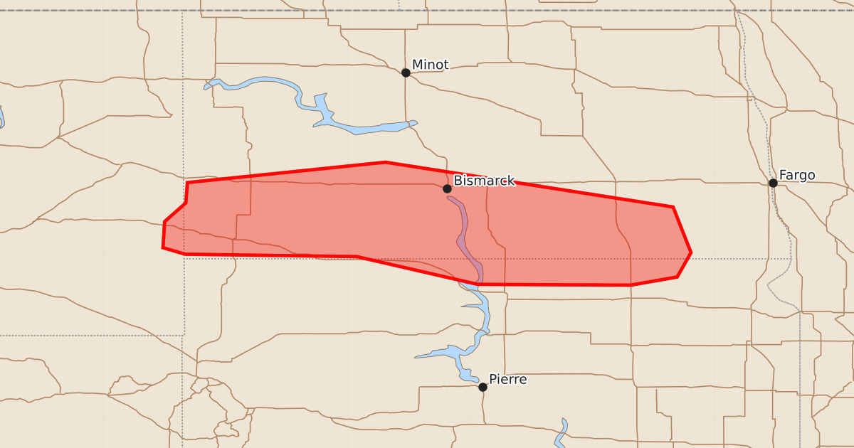
Summary
Severe thunderstorms capable of producing very large hail and strong wind gusts may impact parts of southeast Montana, southern North Dakota, and northern South Dakota this evening. The storms are expected to be severe, with potential hail sizes up to 3.5 inches and wind gusts reaching 70 mph.
Product Text
000 ACUS11 KWNS 112219 SWOMCD SPC MCD 112218 SDZ000-NDZ000-MTZ000-112345- Mesoscale Discussion 1935 NWS Storm Prediction Center Norman OK 0518 PM CDT Tue Aug 11 2026 Areas affected...Parts of far southeast MT into southern ND and far northern SD Concerning...Severe potential...Severe Thunderstorm Watch likely Valid 112218Z - 112345Z Probability of Watch Issuance...80 percent SUMMARY...Trends are being monitored for watch issuance soon with widely spaced supercells that have developed this afternoon. Very large hail and severe gusts may occur with this activity. DISCUSSION...An intense supercell has developed over far southeast MT along/near a front extending eastward from a weak surface low near KBIL, with a separate supercell having also recently developed over south-central ND near the surface boundary. While surface temperatures are not overly warm (generally in the 80s), modifying the 18Z observed BIS sounding for current conditions suggests minimal MLCIN is present along/south of the boundary in southern ND. Enhanced mid-level west-northwesterly flow across the northern Plains is supporting 40-50 kt of deep-layer shear, which will continue to support supercells in the near term. Mid-level lapse rates around 7.6 C/km in the 700-500 mb layer observed on the 18Z BIS sounding and seasonably cool temperatures aloft have fostered moderate to strong instability across southern ND (MLCAPE around 2000-3000 J/kg). Very large hail potentially up to 2-3 inches in diameter will be possible with any sustained supercell, and storm splitting appears probable given the strong westerly deep-layer shear present/nearly straight mid-level hodographs observed. Occasional severe gusts may also occur as low-level lapse rates steepen further. Given ongoing convection, and the potential for additional activity to develop/move eastward into southwest ND from southeast MT, watch issuance is being considered soon. ..Gleason/Mosier.. 08/11/2026 ...Please see www.spc.noaa.gov for graphic product... ATTN...WFO...FGF...ABR...BIS...BYZ... LAT...LON 46000400 46080427 46400425 46630399 46880397 47130154 46589801 46029779 45729796 45629853 45630041 45970189 46000400 MOST PROBABLE PEAK WIND GUST...55-70 MPH MOST PROBABLE PEAK HAIL SIZE...2.00-3.50 IN