Mesoscale Discussion 1912
Issued: · Valid: –
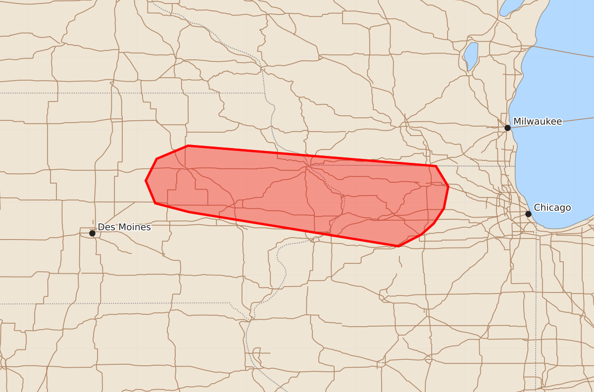
Summary
Developing storms in eastern Iowa and northern Illinois may intensify tonight, potentially bringing severe weather including large hail and brief tornadoes. This severe threat is expected to occur between 7:00 PM and 10:00 PM CDT.
Product Text
000 ACUS11 KWNS 110208 SWOMCD SPC MCD 110207 ILZ000-WIZ000-IAZ000-110400- Mesoscale Discussion 1912 NWS Storm Prediction Center Norman OK 0907 PM CDT Mon Aug 10 2026 Areas affected...Eastern Iowa into northern Illinois Concerning...Severe potential...Watch possible Valid 110207Z - 110400Z Probability of Watch Issuance...60 percent SUMMARY...Convection developing in eastern Iowa will likely intensify in the coming hours and could pose some severe threat for portions of eastern Iowa into northern Illinois. Confidence in exact evolution is limited, but watch issuance may need to be considered. DISCUSSION...Latest regional reflectivity and GOES IR imagery shows steady deepening of nascent convection across eastern IA along a diffuse warm frontal zone. A recent 00 UTC DVN RAOB sampled weak mixed-layer inhibition that is evidently being overcome by ascent within the frontal zone as a nocturnal jet slowly strengthens. This sounding also sampled extreme buoyancy and adequate deep-layer wind shear for organized convection. Consequently, it seems likely that further intensification will occur over the next 1-2 hours. Moderate veering through the lowest 3 km is also noted in the observed hodograph, which should support the potential for a supercell or two capable of producing large hail and perhaps brief tornadoes. The primary uncertainty regarding this potential is the possibility of destructive storm interactions and clustering given forecast storm motions largely along the zone of initiation. This potential is hinted by recent solutions of the HRRR and RRFS, which show initially semi-discrete cells growing upscale into northern IL later this evening. Convective trends will continue to be monitored, and watch issuance may be needed if robust supercells become more imminent. ..Moore/Mosier.. 08/11/2026 ...Please see www.spc.noaa.gov for graphic product... ATTN...WFO...LOT...MKX...DVN...ARX...DMX... LAT...LON 41879229 41999275 42309288 42609273 42789230 42508890 42228873 41928879 41718893 41568910 41408941 41879229 MOST PROBABLE PEAK TORNADO INTENSITY...85-110 MPH MOST PROBABLE PEAK WIND GUST...55-70 MPH MOST PROBABLE PEAK HAIL SIZE...1.00-1.75 IN