Day 2 Convective Outlook
Issued: · Valid: –
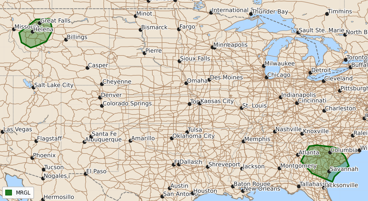
Summary
Isolated severe thunderstorms are possible across parts of eastern Georgia, South Carolina, and far North Florida on Monday. Southwest Montana may also experience isolated severe storms during the late afternoon and evening.
Product Text
000 ACUS02 KWNS 121719 SWODY2 SPC AC 121717 Day 2 Convective Outlook NWS Storm Prediction Center Norman OK 1217 PM CDT Sun Jul 12 2026 Valid 131200Z - 141200Z ...THERE IS A MARGINAL RISK OF SEVERE THUNDERSTORMS WITHIN PARTS OF EASTERN GEORGIA INTO SOUTH CAROLINA...AND SOUTHWEST MONTANA... ...SUMMARY... A few strong-to-severe storms will be possible from South Carolina into central Georgia and far North Florida on Monday. Additional isolated severe storms are possible in southwestern Montana. ...Synopsis... Upper-level ridging will continue to build across the CONUS on Monday. Strong cyclonic flow will exist across the Pacific Northwest into the northern Rockies. A weak upper-level low will be present in the Tennessee Valley/southern Appalachians. A stalled surface boundary will be draped across the southern Plains into the Carolinas. ...Georgia/South Carolina... A stalled surface boundary will continue to be the focus for convection on Monday. Surface heating is expected to be less than previous days. Even so, a weak upper low will bring subtle lift/flow enhancement near the surface boundary. Overall storm organization will be low. That said, around 20 kt of shear near the boundary, large PWAT values, and scattered/numerous storms will promote a risk of water-loaded downdrafts capable of isolated wind damage. ...Southwest Montana... Model trends have suggested that sufficient moisture/destabilization will be in place by late afternoon into the evening. Isolated to widely scattered storms are expected to develop within the higher terrain and move quickly northeastward. Temperatures in the upper 80s/low 90s F and inverted-v thermodynamic profiles will support a risk for severe winds. ...Arizona... Temperatures are expected to be cooler on Monday on account of the impacts of weekend convection. Coupled with weaker and slightly more southwesterly mid-level winds, it is not clear how much strong to potentially severe activity will be able to move off of the Mogollon Rim during the afternoon/evening. A stronger storm or two could produce gusty outflow winds where greater heating can occur, but this activity should be much more spatially limited than previous days. ..Wendt.. 07/12/2026 $$