Mesoscale Discussion 1250
Issued: · Valid: –
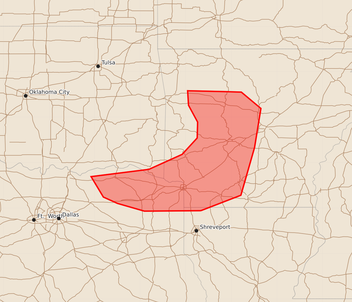
Summary
Strong wind gusts from a weakening thunderstorm complex are expected across portions of southeastern Oklahoma, western and central Arkansas, northwest Louisiana, and northeast Texas through 9 am CDT. The severe wind threat is expected to diminish after 14z.
Product Text
000 ACUS11 KWNS 221103 SWOMCD SPC MCD 221103 ARZ000-LAZ000-TXZ000-OKZ000-221300- Mesoscale Discussion 1250 NWS Storm Prediction Center Norman OK 0603 AM CDT Mon Jun 22 2026 Areas affected...portions of southeastern Oklahoma...western and central Arkansas...northwest Louisiana...and northeast Texas Concerning...Severe Thunderstorm Watch 373... Valid 221103Z - 221300Z The severe weather threat for Severe Thunderstorm Watch 373 continues. SUMMARY...A weakening bowing complex of strong/severe thunderstorms will continue to produce strong to severe wind gusts through 9 am CDT. DISCUSSION...Mosaic radar imagery at 11z depicts a bowing complex of thunderstorms over far western AR, southeast OK and northeast TX, moving east at around 45 mph while storms along the southern periphery sag southeast. This complex, which originated over western KS Sunday afternoon, has exhibited a gradual weakening trend over the past two hours as evidenced by a diminishing rear-inflow jet and lower leading edge reflectivity. Nevertheless, at least some potential for strong/near severe gusts will continue through 13-14z given the fast system movement, presence of moderate/strong MLCAPE in the downstream environment, and a slowly veering low-level jet. Beyond 13-14z, the severe threat should continue to diminish with time as the weakening trend continues, in line with short-term high-res guidance. ..Bunting.. 06/22/2026 ...Please see www.spc.noaa.gov for graphic product... ATTN...WFO...LZK...SHV...TSA...FWD... LAT...LON 32949367 32939491 33109550 33249581 33699608 33859481 34189408 34549375 34899374 35269394 35589396 35569311 35559278 35199235 34339249 33289279 32949367 MOST PROBABLE PEAK TORNADO INTENSITY...UP TO 90 MPH MOST PROBABLE PEAK WIND GUST...UP TO 60 MPH