Mesoscale Discussion 2123
Issued: · Valid: –
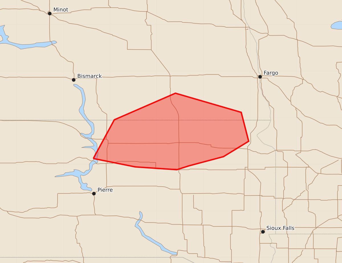
Summary
Severe thunderstorms capable of producing 75 mph wind gusts and large hail will move through north-central and northeast South Dakota into far southeast North Dakota through late evening.
Product Text
000 ACUS11 KWNS 250216 SWOMCD SPC MCD 250216 SDZ000-NDZ000-250345- Mesoscale Discussion 2123 NWS Storm Prediction Center Norman OK 0916 PM CDT Mon Aug 24 2026 Areas affected...North-central/northeast SD into far southeast ND Concerning...Severe Thunderstorm Watch 624...625... Valid 250216Z - 250345Z The severe weather threat for Severe Thunderstorm Watch 624, 625 continues. SUMMARY...The severe threat may spread southeastward into late evening. DISCUSSION...A small cluster of storms has recently become somewhat better organized south and southwest of Jamestown, ND, with a recent gust of 77 mph observed in McIntosh County. The 00Z ABR sounding depicted substantial CINH for surface-based parcels, though considerably weaker CINH and strong buoyancy for parcels rooted around 850 mb. This thermodynamic profile within a modest warm-advection regime may allow for persistence of the ongoing cluster into late evening as it moves southeastward, assuming the cold pool remains sufficiently strong. Severe gusts (potentially near/above 75 mph) will remain possible with this cluster as it moves into northeast SD, while isolated hail will also be possible with the strongest embedded cells. WW 624 has been expanded in order to address this threat. ..Dean.. 08/25/2026 ...Please see www.spc.noaa.gov for graphic product... ATTN...WFO...FGF...ABR...BIS... LAT...LON 45120036 45959991 46529860 46119719 45499703 45169757 44969832 44889857 44949946 45120036 MOST PROBABLE PEAK TORNADO INTENSITY...UP TO 90 MPH MOST PROBABLE PEAK WIND GUST...65-80 MPH MOST PROBABLE PEAK HAIL SIZE...1.50-2.50 IN