Day 3 Convective Outlook
Issued: · Valid: –
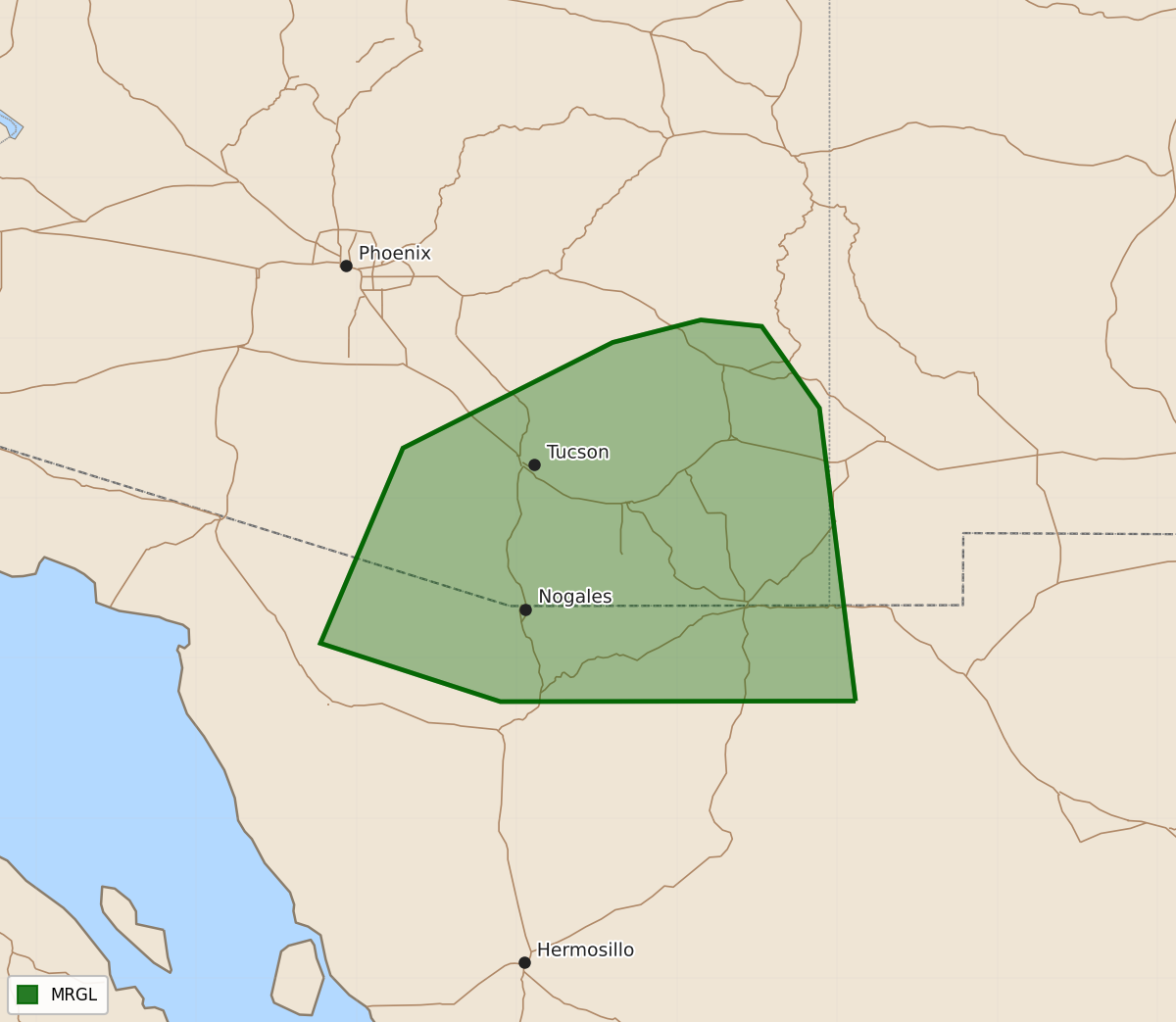
Summary
Scattered severe thunderstorms capable of producing damaging wind gusts are possible across southeast Arizona on Tuesday afternoon and evening.
Product Text
000 ACUS03 KWNS 020718 SWODY3 SPC AC 020717 Day 3 Convective Outlook NWS Storm Prediction Center Norman OK 0217 AM CDT Sun Aug 02 2026 Valid 041200Z - 051200Z ...THERE IS A MARGINAL RISK OF SEVERE THUNDERSTORMS OVER SOUTHEAST ARIZONA... ...SUMMARY... Widely scattered severe storms capable of severe wind gusts appear possible in southeast Arizona Tuesday afternoon and evening. ...Synopsis... A broad, cyclonic flow regime is forecast from the northern Rockies into the Great Lakes, to the north of an elongating upper high over the Lower CO Valley into the southern Rockies. Within that pattern, there is a model signal that a low-amplitude disturbance and associated mid-level wind maximum will move through the mid MO Valley Tuesday night. At the surface, a front will progress through portions of the upper Great Lakes with the boundary trailing southwest through the mid MO Valley to an area of low pressure over the central High Plains. ...Southeast Arizona... A similar setup to that on Monday is expected Tuesday afternoon with a deep, well-mixed boundary layer and moderate instability enhancing downdraft potential as storms move into the lower desert. Slightly stronger easterly mid-level flow may boost deep-layer shear to around 30 kt, potentially leading to some cold pool organization and an associated threat for a few severe wind gusts. ...Mid Missouri Valley... Elevated thunderstorms may be ongoing Tuesday morning north of the surface front with the potential for lingering clouds to limit air mass destabilization in some areas. A corridor of moderate instability may develop south of the front by afternoon from northeast KS into southern IA; however, the absence of appreciable forcing mechanisms leads to considerable uncertainty in whether any surface-based storms will develop during the daylight hours. There is a greater confidence in elevated storm potential Tuesday night north of the front with the approach of the mid-level disturbance. While there is some model variance with respect to the degree of elevated instability, the general consensus is for MUCAPE less than 1000 J/kg with poor mid-level lapse rates. Thus, despite the presence of seasonably strong vertical shear, the marginal thermodynamic environment is currently expected to limit severe weather potential. ...Central High Plains... Model differences in the boundary-layer structure within the post-frontal upslope along with the presence of a cap centered around 600 mb lead to uncertainty in surface-based storm development and sustenance Tuesday afternoon and evening. Should storms develop, the presence of 30-40+ kt of deep-layer shear would support some severe weather threat. However, confidence in that scenario is currently too low to include a 5% probability contour. ..Mead.. 08/02/2026 $$