Mesoscale Discussion 1475
Issued: · Valid: –
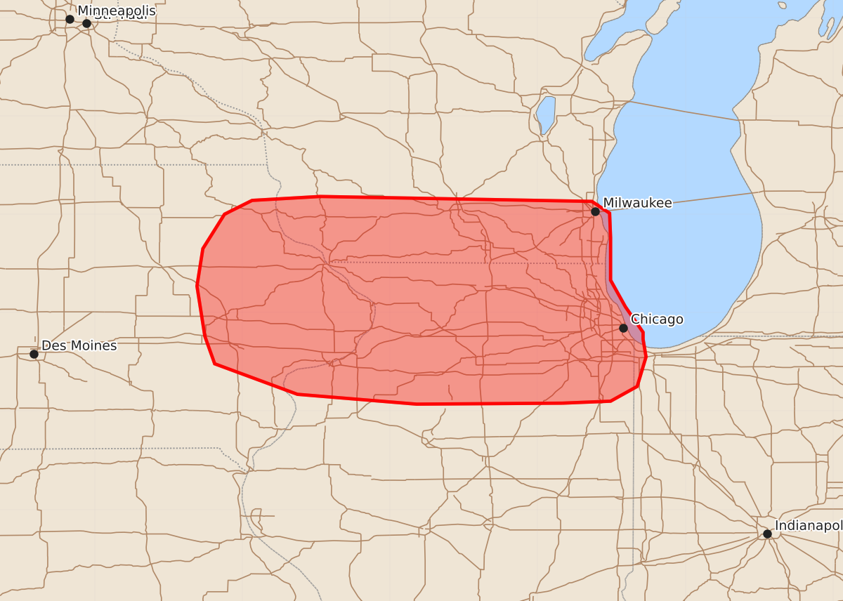
Summary
Potential severe thunderstorms capable of producing wind gusts up to 70 mph and 1.25-inch hail are being monitored for eastern Iowa, southern Wisconsin, and northern Illinois through this evening. The severity of these storms depends on whether developing convection intensifies and clusters over the next few hours.
Product Text
000 ACUS11 KWNS 032206 SWOMCD SPC MCD 032205 INZ000-ILZ000-WIZ000-IAZ000-040000- Mesoscale Discussion 1475 NWS Storm Prediction Center Norman OK 0505 PM CDT Fri Jul 03 2026 Areas affected...Eastern Iowa into southern Wisconsin and northern Illinois Concerning...Severe potential...Watch possible Valid 032205Z - 040000Z Probability of Watch Issuance...40 percent SUMMARY...Convective trends are being monitored across eastern Iowa into southern Wisconsin and northern Illinois. Watch issuance is possible if further convective intensification and clustering can occur in the coming hours. DISCUSSION...Weak convection has been percolating along a residual outflow boundary across eastern IA and into southern WI/northwest IL over the past hour. Despite temperatures warming back into the 80s and dewpoints recovering into the 70s, prior convective overturning appears to be limiting the overall thermodynamic environment across this region, resulting in the anemic convective development observed so far. Further south, a more diffuse outflow boundary associated with a weak MCS currently over Lower MI is beginning to advance northward. Convective development in proximity to the boundary as well as notable boundary-layer cumulus along/south of the boundary hint that this demarcates the northern extent of the more buoyant/unstable air mass (characterized by MLCAPE values of 2000-3000 J/kg). It remains unclear how far north this boundary will progress through mid-evening, but it is conceivable that the more buoyant air mass will continue to spread north, eventually reaching the boundary draped across eastern IA and the IL/WI border. If this occurs, further intensification of convection will be possible, and downstream propagation across northern IL may occur. It is also possible that developing convection along the southern boundary continues to intensify and could pose a more transient and localized hail/wind risk in the coming hours. Confidence in either scenario is relatively limited, but trends are being monitored for the need for watch issuance this evening. ..Moore/Gleason.. 07/03/2026 ...Please see www.spc.noaa.gov for graphic product... ATTN...WFO...LOT...ILX...MKX...DVN...ARX... LAT...LON 41088825 41078973 41179094 41489178 41769188 42279196 42659190 43009168 43149140 43189071 43138795 43018777 42768776 42338776 42068761 41808743 41738743 41558740 41258749 41108776 41088825 MOST PROBABLE PEAK WIND GUST...55-70 MPH MOST PROBABLE PEAK HAIL SIZE...UP TO 1.25 IN