Mesoscale Discussion 1709
Issued: · Valid: –
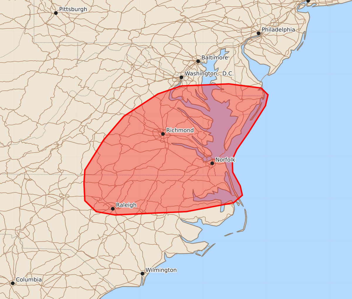
Summary
Strong to occasionally severe thunderstorms may bring isolated damaging wind gusts and a brief tornado to portions of the Mid-Atlantic through this evening. These storms are expected to be limited in severity.
Product Text
000 ACUS11 KWNS 221740 SWOMCD SPC MCD 221740 MDZ000-DEZ000-VAZ000-NCZ000-221945- Mesoscale Discussion 1709 NWS Storm Prediction Center Norman OK 1240 PM CDT Wed Jul 22 2026 Areas affected...portions of the Mid-Atlantic Concerning...Severe potential...Watch unlikely Valid 221740Z - 221945Z Probability of Watch Issuance...20 percent SUMMARY...Strong to occasionally severe thunderstorms will bring the potential for isolated damaging wind gusts and perhaps a brief tornado through this evening. DISCUSSION...A prefrontal band of precipitation with embedded thunderstorms remains ongoing across southern Virginia as of early afternoon, with an area of denser cloud cover extending downstream from this precipitation along the VA/NC border. This ongoing thunderstorm activity is expected to spread eastward through this afternoon, eventually interacting with greater buoyancy across far eastern NC where dewpoints are in the upper 70s F. Additional development is also anticipated along/ahead of an approaching cold front across central and eastern Virginia where a relative lack of cloud cover has allowed for stronger surface heating. This activity will occur along the southern periphery of stronger mid/upper flow, with effective shear of 30-40+ kts (greater with northward extent) supporting a mixed mode of clusters and supercells. The primary risk with this activity will be for isolated damaging wind gusts, with the greatest potential likely to exist where low-level lapse rates can appreciably steepen. A brief tornado also cannot be ruled out given modestly enhanced low-level flow (~30 kts sampled by the AKQ/MHX VAD profiles). However, veered low-level flow across the region, poor mid-level lapse rates, and the likelihood that low-level lapse rates will be at least somewhat tempered by the aforementioned cloud cover suggest that convective severity/intensity are likely to remain limited. Thus, watch issuance appears unlikely at this time. ..Chalmers/Thompson.. 07/22/2026 ...Please see www.spc.noaa.gov for graphic product... ATTN...WFO...PHI...AKQ...MHX...LWX...RAH...RNK... LAT...LON 37417886 37977838 38507757 38697702 38747588 38647511 38487495 38227501 37577542 37187569 36947580 36647579 36317561 36097556 35917577 35707689 35627859 35707904 35967931 36387933 36697931 37417886 MOST PROBABLE PEAK TORNADO INTENSITY...UP TO 90 MPH MOST PROBABLE PEAK WIND GUST...UP TO 60 MPH