Mesoscale Discussion 1190
Issued: · Valid: –
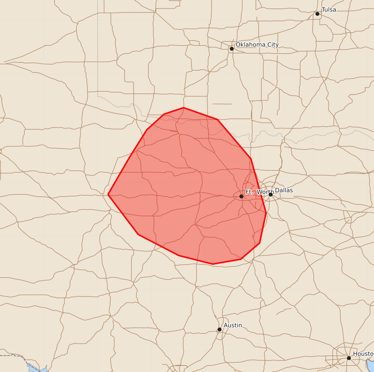
Summary
A severe thunderstorm cluster may develop over southern Oklahoma and north-central Texas this evening, potentially bringing wind gusts exceeding 75 mph.
Product Text
000 ACUS11 KWNS 182251 SWOMCD SPC MCD 182251 TXZ000-OKZ000-190045- Mesoscale Discussion 1190 NWS Storm Prediction Center Norman OK 0551 PM CDT Thu Jun 18 2026 Areas affected...portions of extreme southern Oklahoma into north-central Texas Concerning...Severe potential...Watch possible Valid 182251Z - 190045Z Probability of Watch Issuance...60 percent SUMMARY...An MCS may develop over the next few hours and produce a severe wind swath. A few gusts exceeding 75 mph will be possible. A Severe Thunderstorm Watch may be needed once timing of convective initiation can be better ascertained. DISCUSSION...A cold front and modified outflow boundary continue to sag southward along the Red River, where a minimally capped, extremely unstable airmass resides. South of the Red River, 90-100 F/upper 70s F surface temperatures/dewpoints, beneath 8+ C/km mid-level lapse rates, supports 4500-5500 J/kg MLCAPE. However, vertical wind shear south of the Red River remains poor given stronger mid-level flow displaced farther north, away from the surface-based airmass. Towering CU have been noted at the intersection of the modified outflow boundary/cold front, and the current thinking is that convergence along these boundaries will eventually support robust convective development. Rapid cold pool mergers (due to weak vertical wind shear), amid extreme instability, may support a burst-MCS, with an initial and intense outflow surge capable of producing a severe wind swath. Given the weak shear, most severe gusts will probably remain in the 60-70 mph range. However, gusts exceeding 75 mph are possible given downdraft water-loading and subsequent evaporative cooling within an extremely buoyant environment. It remains unclear when storms will initiate. However, should storm initiation and organization becomes apparent, a Severe Thunderstorm Watch will be needed. ..Squitieri/Smith.. 06/18/2026 ...Please see www.spc.noaa.gov for graphic product... ATTN...WFO...FWD...OUN...SJT... LAT...LON 32779981 33469941 33979909 34269877 34389841 34169778 33439716 32439688 31879700 31579735 31489787 31649850 32039925 32779981 MOST PROBABLE PEAK WIND GUST...65-80 MPH