Mesoscale Discussion 1451
Issued: · Valid: –
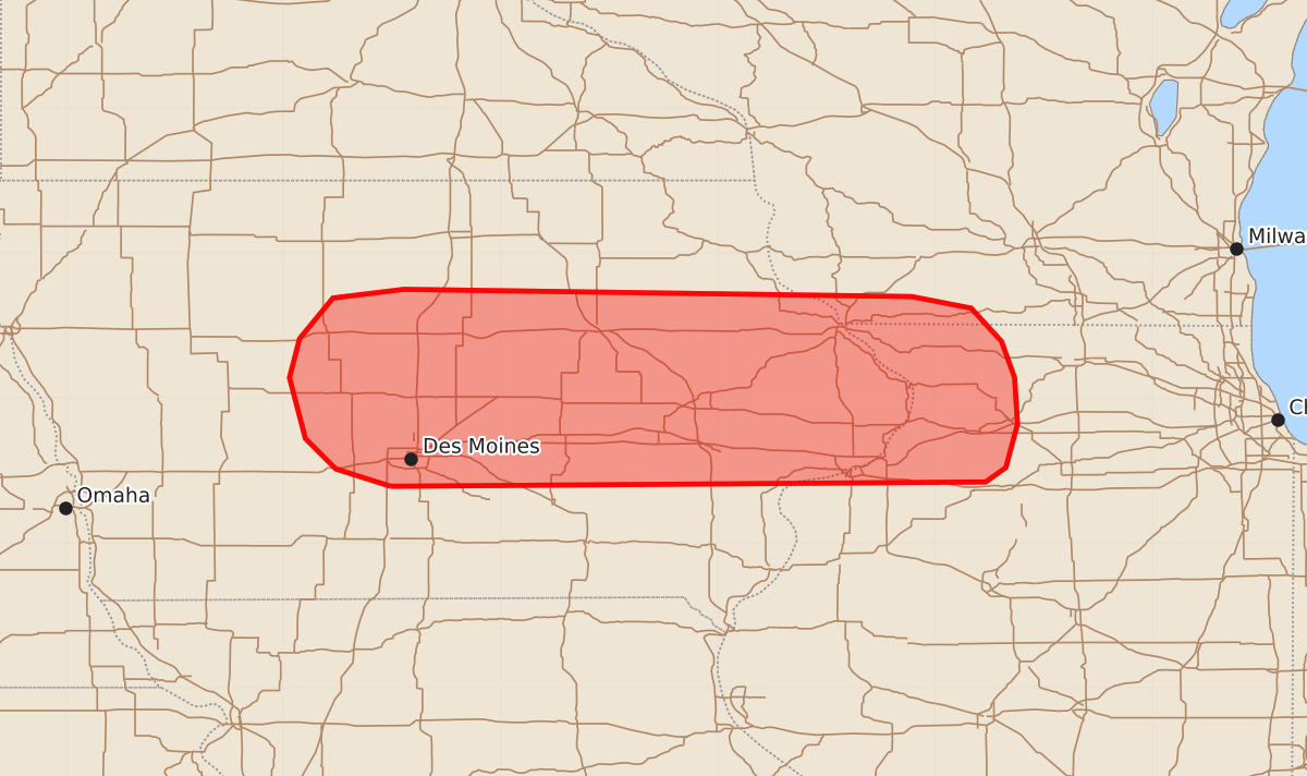
Summary
Severe thunderstorms capable of producing large hail and strong wind gusts are expected to affect central and eastern Iowa, as well as northwest Illinois, through the evening. The most significant hail threat will persist in central Iowa for the next one to two hours before potentially shifting eastward.
Product Text
000 ACUS11 KWNS 022242 SWOMCD SPC MCD 022242 ILZ000-WIZ000-IAZ000-030045- Mesoscale Discussion 1451 NWS Storm Prediction Center Norman OK 0542 PM CDT Thu Jul 02 2026 Areas affected...Central to eastern Iowa Concerning...Severe Thunderstorm Watch 437... Valid 022242Z - 030045Z The severe weather threat for Severe Thunderstorm Watch 437 continues. SUMMARY...The threat for severe hail will likely persist for another 1-2 hours across central Iowa. Some hail threat may manifest across eastern Iowa and possibly northwest Illinois through the evening. DISCUSSION...Semi-discrete storm development continues across central IA where modest 925-850 mb flow continues to overrun a sagging outflow boundary draped across the state. Based on MRMS VII imagery, several of these cores have at least briefly intensified to severe levels (with occasional 1-inch hail reported) before becoming displaced further north into the cold pool. Aloft, the passage of an upper wave across the mid-MO River valley will likely maintain broad scale ascent over the region and help maintain southerly flow into the southern portion of the cold pool/outflow. Lifted indices on the order of -8 to -10 C remain within the warm sector where updrafts are originating, and deep-layer shear within the effective layer of around 30-35 knots should maintain the potential for robust updrafts and transient supercells at least for another couple of hours. The primarily modulating factor for overall storm intensity will be destructive storm interactions and rapid displacement to the cool side of the boundary. With time, eastward propagation of the cold pool may shift the primary corridor of severe hail potential eastward into eastern IA and possibly as far east as northwest IL. Trends will continue to be monitored, and local temporal extension and/or expansion of WW 437 may be needed as we approach the 00 UTC expiration time. ..Moore.. 07/02/2026 ...Please see www.spc.noaa.gov for graphic product... ATTN...WFO...LOT...MKX...DVN...ARX...DMX... LAT...LON 41399376 41519414 41729435 42149446 42419439 42699416 42759367 42709016 42628975 42398954 42148945 41828943 41528951 41428965 41399376 MOST PROBABLE PEAK WIND GUST...55-70 MPH MOST PROBABLE PEAK HAIL SIZE...UP TO 1.25 IN