Day 1 Convective Outlook
This product has been superseded. View the updated product →
Issued: · Valid: –
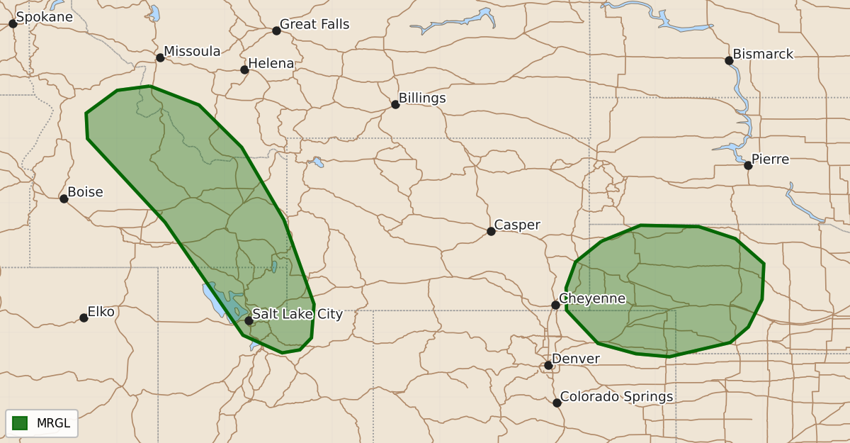
Summary
Isolated severe thunderstorms with hail and wind gusts are possible across parts of the Intermountain West and the central High Plains late this afternoon and early evening.
Product Text
000 ACUS01 KWNS 170549 SWODY1 SPC AC 170547 Day 1 Convective Outlook NWS Storm Prediction Center Norman OK 1247 AM CDT Thu Sep 17 2026 Valid 171200Z - 181200Z ...THERE IS A MARGINAL RISK OF SEVERE THUNDERSTORMS ACROSS PARTS OF THE INTERMOUNTAIN WEST AND IN THE CENTRAL HIGH PLAINS... ...SUMMARY... Thunderstorms with isolated severe wind gusts and hail will be possible in parts of the Intermountain West late this afternoon and early this evening. A few strong gusts may also occur in parts of the central High Plains. ...Intermountain West... An upper-level low will move inland into the Intermountain West today, as southwest flow remains at mid-levels over much of the region. At the surface, a trough will deepen from southern Idaho into western Utah. To the east of the trough, dewpoints in the 50s F, will contribute to weak instability by afternoon. As surface temperatures warm, thunderstorms will develop in the higher terrain. RAP forecast soundings to the east of the trough at 00Z have 0-6 km shear in the 30 to 40 knot range. In addition, low to mid-level lapse rates are forecast to be in the 6.5 to 7.5 C/km range. This environment will likely support an isolated threat for severe gusts and hail. The threat should be concentrated during the late afternoon and early evening, as cell coverage maximizes near the instability axis. ...Central High Plains... An upper-level ridge will move eastward today across the north-central U.S, as a shortwave trough embedded in the ridge moves through the central High Plains. At the surface, a warm front is forecast to move slowly northward across southern and western Nebraska this afternoon. An axis of moisture, with surface dewpoints in the 60s and 70s F, will be oriented north of the front from the mid Missouri Valley west-northwestward into the central High Plains. During the late afternoon, scattered thunderstorms are expected to develop near the shortwave trough, with storms moving gradually northeastward across the central High Plains. Forecast soundings near the area of greatest expected convective coverage have moderate deep-layer shear suggesting an isolated severe threat will be possible. However, lapse rates are forecast to be poor, which should keep any severe threat marginal. If storms near the front can remain nearly surface-based, then an isolated wind-damage threat could develop, mainly during the early to mid evening, as low-level flow increases. ..Broyles/Thornton.. 09/17/2026 $$