Mesoscale Discussion 1314
Issued: · Valid: –
Summary
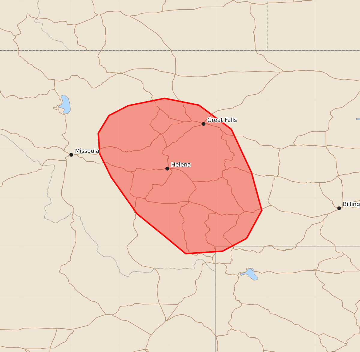
Scattered thunderstorms may bring occasional large hail and severe wind gusts to central Montana through the early evening.
Product Text
000 ACUS11 KWNS 252006 SWOMCD SPC MCD 252006 WYZ000-MTZ000-252200- Mesoscale Discussion 1314 NWS Storm Prediction Center Norman OK 0306 PM CDT Thu Jun 25 2026 Areas affected...Central Montana Concerning...Severe potential...Watch unlikely Valid 252006Z - 252200Z Probability of Watch Issuance...5 percent SUMMARY...Scattered loosely organized thunderstorms may pose a risk of sporadic large hail and severe gusts through early evening. Watch issuance is not expected. DISCUSSION...Convection has been gradually intensifying within the higher terrain of central Montana over the past hour as diurnal heating drives increasing buoyancy and upslope flow/orographic ascent. This activity is also largely focused under the upper-level thermal trough where 500 mb temperatures are as cold as -15 C per the 18 UTC TFX RAOB. These cold temperatures aloft are supporting a pocket of somewhat limited buoyancy (MUCAPE of only around 500-1000 J/kg), but even this modest buoyancy profile may be adequate to allow deeper convection to be influenced by the 25-30 knot mid-level flow inferred by regional RAOBs with southward extent. This may support some transient organization of the deeper, more intense cores with an attendant threat for occasional large hail and severe gusts through early evening. In general, however, the overall thermodynamic and kinematic environment appears too limited for a particularly widespread or prolonged severe threat. ..Moore/Guyer.. 06/25/2026 ...Please see www.spc.noaa.gov for graphic product... ATTN...WFO...BYZ...RIW...TFX...MSO... LAT...LON 47881139 47391073 46511032 45741011 45171042 44911091 44861166 45201207 45671265 46421318 46891341 47311344 47671322 47871283 48021209 47881139 MOST PROBABLE PEAK WIND GUST...UP TO 60 MPH MOST PROBABLE PEAK HAIL SIZE...1.00-1.75 IN