Mesoscale Discussion 1179
Issued: · Valid: –
Summary
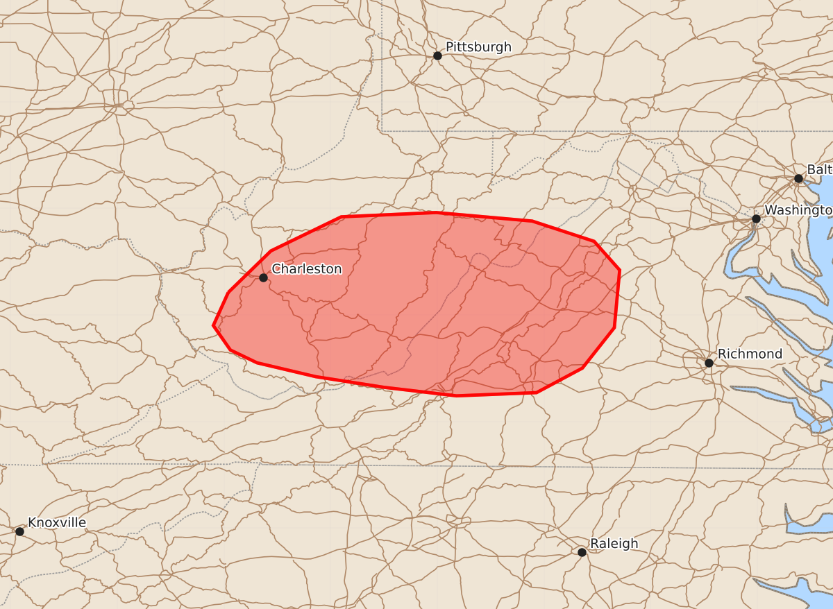
Damaging wind gusts and an isolated tornado threat are expected across West Virginia and northwestern Virginia throughout the morning. The severe weather is expected to develop within the next few hours.
Product Text
000 ACUS11 KWNS 181044 SWOMCD SPC MCD 181043 VAZ000-WVZ000-181245- Mesoscale Discussion 1179 NWS Storm Prediction Center Norman OK 0543 AM CDT Thu Jun 18 2026 Areas affected...West Virginia...Northwestern Virginia Concerning...Severe potential...Watch possible Valid 181043Z - 181245Z Probability of Watch Issuance...60 percent SUMMARY...A potential for severe wind gusts is expected to develop over much of West Virginia into northwestern Virginia this morning. Additional weather watch issuance may be needed. DISCUSSION...A severe MCS is currently ongoing near an axis of moderate instability located from central Kentucky east-northeastward into western West Virginia. The eastern edge of this instability is forecast to shift eastward across the remainder of West Virginia and into northwestern Virginia over the next few hours. This should be enough to maintain a severe threat with the eastern edge of an MCS as it moves into the central Appalachians. Just to the south of the MCS, the Jackson, Kentucky WSR-88D VWP has 0-6 km shear near 70 knots. This will likely support an isolated severe threat, mainly with short bowing line segments. The primary threat will be damaging wind gusts, but an isolated tornado threat will also be possible. ..Broyles/Guyer.. 06/18/2026 ...Please see www.spc.noaa.gov for graphic product... ATTN...WFO...AKQ...LWX...RNK...RLX... LAT...LON 38218196 38608156 38928090 38968001 38887911 38697853 38427829 37887834 37507864 37277907 37247982 37328050 37428114 37558169 37678194 37908210 38218196 MOST PROBABLE PEAK TORNADO INTENSITY...UP TO 90 MPH MOST PROBABLE PEAK WIND GUST...UP TO 60 MPH