Mesoscale Discussion 1975
Issued: · Valid: –
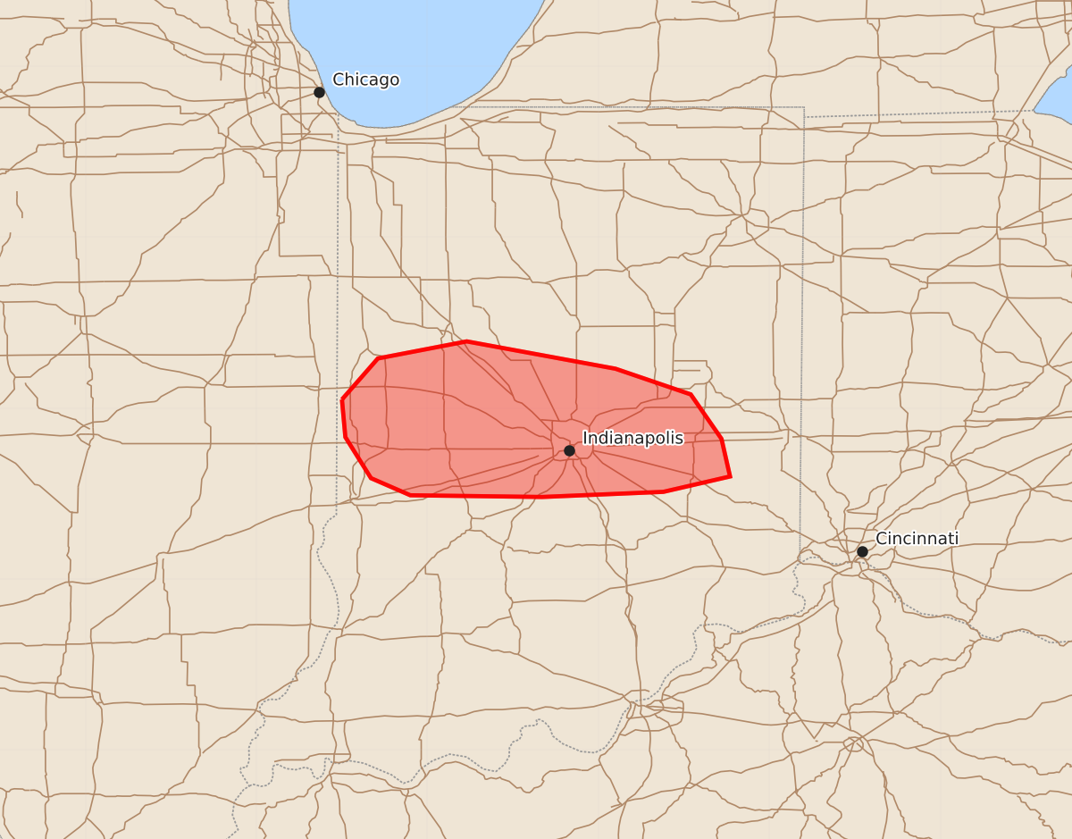
Summary
A cluster of storms moving through central Indiana may produce damaging wind gusts of 55 to 70 mph and isolated hail during the early morning hours of Friday, August 14.
Product Text
000 ACUS11 KWNS 140631 SWOMCD SPC MCD 140630 INZ000-140830- Mesoscale Discussion 1975 NWS Storm Prediction Center Norman OK 0130 AM CDT Fri Aug 14 2026 Areas affected...Central IN Concerning...Severe potential...Watch possible Valid 140630Z - 140830Z Probability of Watch Issuance...40 percent SUMMARY...Wind-damage potential will spread east-southeastward with an ongoing storm cluster, though longevity of the threat is uncertain. DISCUSSION...A small southeastward-moving storm cluster has evolved across west-central IN, with another isolated strong to potentially severe storm ongoing north of Indianapolis. This somewhat elevated convection has developed north of an outflow-reinforced front, within a low-level warm-advection regime that will continue for much of the overnight. MUCAPE of 1000-2000 J/kg and 30-40 kt of effective shear will continue to support organized storms. The modest upscale growth noted across west-central IN could lead to an increase in wind-damage potential over the next 1-2 hours. However, the magnitude of the threat is uncertain due to lingering near-surface stability, and recent objective mesoanalyses depict decreasing MUCAPE and increasing MUCINH with southeastward extent. If a robust cold pool can become established, then a more organized wind-damage threat could evolve across a larger portion of central IN with time. Otherwise, localized strong/damaging gusts will continue to be possible, and some potential for isolated hail may persist with the remaining semi-discrete cells. ..Dean/Mosier.. 08/14/2026 ...Please see www.spc.noaa.gov for graphic product... ATTN...WFO...ILN...IND... LAT...LON 40058750 40298729 40398677 40238590 40088546 39828528 39608523 39518562 39488633 39498710 39598733 39838748 40058750 MOST PROBABLE PEAK WIND GUST...55-70 MPH MOST PROBABLE PEAK HAIL SIZE...UP TO 1.25 IN