Mesoscale Discussion 1466
Issued: · Valid: –
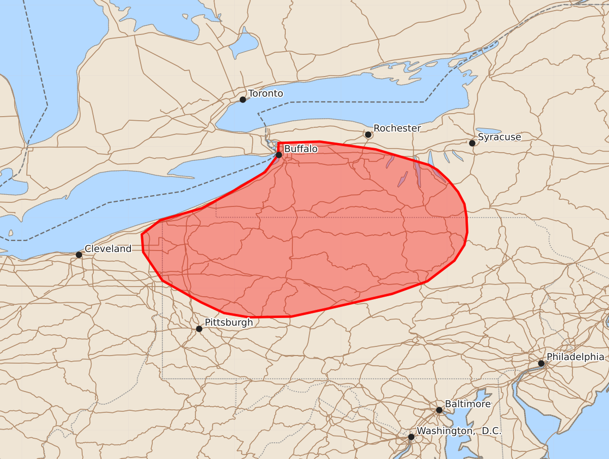
Summary
Strong to severe thunderstorms capable of producing 55-70 mph wind gusts are expected this afternoon across northern Pennsylvania and southwestern New York.
Product Text
000 ACUS11 KWNS 031626 SWOMCD SPC MCD 031625 NYZ000-PAZ000-OHZ000-031830- Mesoscale Discussion 1466 NWS Storm Prediction Center Norman OK 1125 AM CDT Fri Jul 03 2026 Areas affected...Northern Pennsylvania into southwestern New York Concerning...Severe potential...Watch possible Valid 031625Z - 031830Z Probability of Watch Issuance...60 percent SUMMARY...Strong to severe thunderstorms are expected this afternoon across portions of northern Pennsylvania into southwestern New York, some of which will be capable of 55-70 MPH wind gusts. DISCUSSION...Thunderstorms have begun developing in far northwestern Pennsylvania amidst a general trend of deepening boundary layer cumulus on visible satellite. Surface temperatures have already risen into the low 90s F, which already exceeds the estimated convective temperature from the 12Z PIT sounding. The expectation is that convective coverage should increase over the next few hours, especially across northern Pennsylvania and southwestern New York. These storms will exist in an environment characterized by both steep low-level and mid-level lapse rates, but generally weak deep-layer shear of 10-15 kts. While the lack of shear will support primarily disorganized thunderstorms and loose clusters, the steep lapse rates, modest precipitable water content, and high LCL heights will support strong thunderstorm downdrafts capable of winds of 55-70 MPH. Both the 12Z HREF and the latest HRRR/RRFS time-lagged ensemble suggests there could be multiple rounds of convective development off of the Great Lakes, and some of these storms may loosely cluster into bowing outflow segments. However, the uncertainty in convective organization and spatial coverage of potential damaging wind gusts limits confidence in watch issuance at this time. Conditions will continue to be monitored for a severe thunderstorm watch. ..Halbert/Hart.. 07/03/2026 ...Please see www.spc.noaa.gov for graphic product... ATTN...WFO...BGM...BUF...CTP...PBZ...CLE... LAT...LON 40908015 41118052 41518079 41768081 41968055 42137996 42367954 42647907 42887889 43057888 43077830 42967751 42747676 42677664 42537649 42367635 42197626 42017623 41797622 41617626 41397640 41107678 40927728 40707824 40607870 40597930 40657965 40807997 40908015 MOST PROBABLE PEAK WIND GUST...55-70 MPH