Mesoscale Discussion 1976
Issued: · Valid: –
Summary
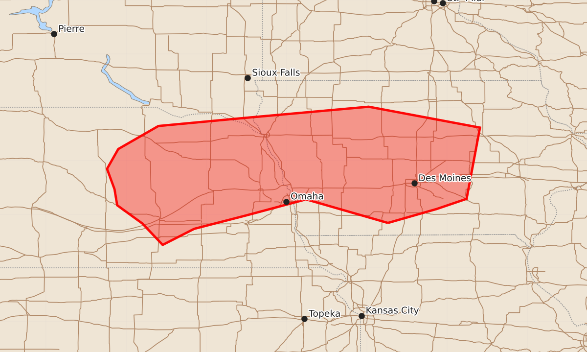
Isolated strong to severe storms capable of producing damaging wind gusts and small hail are possible overnight across central and eastern Nebraska, western and central Iowa, and extreme southeast South Dakota.
Product Text
000 ACUS11 KWNS 140720 SWOMCD SPC MCD 140720 IAZ000-NEZ000-SDZ000-140945- Mesoscale Discussion 1976 NWS Storm Prediction Center Norman OK 0220 AM CDT Fri Aug 14 2026 Areas affected...Central/eastern NE into western/central IA and extreme southeast SD Concerning...Severe potential...Watch unlikely Valid 140720Z - 140945Z Probability of Watch Issuance...20 percent SUMMARY...Strong to locally severe storms are possible overnight. DISCUSSION...A bowing segment associated with a long-lived MCS is moving northeastward across south-central NE. While this system has generated a well-defined MCV, convection has shown a weakening trend early this morning, with only sporadic severe gusts noted over the last 1-2 hours. Some rejuvenation of convection along the gust front cannot be ruled out as it moves within an elevated buoyancy gradient and zone of low-level warm advection, but the remaining severe-gust threat with this system is currently expected to remain isolated. Farther east, an arc of elevated convection has developed early this morning from northeast NE into southwest IA. This convection has developed within the warm-advection regime to the north of a surface front draped across northern KS/MO. Storms may continue to increase in coverage as they spread northeastward with time overnight. Relatively steep midlevel lapse rates and MUCAPE increasing above 2000 J/kg will favor vigorous updrafts. Mid/upper-level flow is generally weak, and effective shear for storms rooted around 850 mb is less than 30 kt. Given the weak shear, the overnight severe threat is expected to remain rather isolated. However, effective SRH will be more favorable for storms that can become rooted closer to the surface, which could result in at least transient storm organization. Isolated hail will be possible with the strongest cells, while the favorable buoyancy and large PW (near/above 2 inches) will support localized downburst potential, even with the persistence of a near-surface stable layer. ..Dean/Mosier.. 08/14/2026 ...Please see www.spc.noaa.gov for graphic product... ATTN...WFO...DMX...FSD...OAX...GID...LBF... LAT...LON 40849411 41289564 40989676 40739773 40439832 40839870 41179917 41479922 41859936 42229915 42659840 42809680 43019447 42629239 41299264 41109320 40849411 MOST PROBABLE PEAK WIND GUST...55-70 MPH MOST PROBABLE PEAK HAIL SIZE...UP TO 1.25 IN