Mesoscale Discussion 1489
Issued: · Valid: –
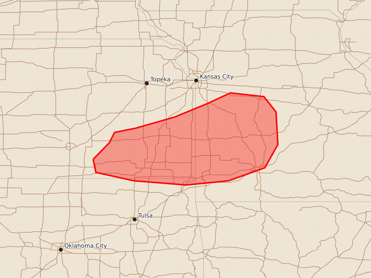
Summary
A cluster of strong to severe thunderstorms may develop and intensify across southeast Kansas into western Missouri through late morning. The primary threat is damaging wind gusts, though hail is also possible.
Product Text
000 ACUS11 KWNS 041509 SWOMCD SPC MCD 041509 MOZ000-KSZ000-OKZ000-041745- Mesoscale Discussion 1489 NWS Storm Prediction Center Norman OK 1009 AM CDT Sat Jul 04 2026 Areas affected...southeast Kansas into western Missouri Concerning...Severe potential...Watch possible Valid 041509Z - 041745Z Probability of Watch Issuance...40 percent SUMMARY...A cluster of strong to severe storms may persist and eventually intensify further as it develops from Kansas into Missouri today. Damaging wind gusts are the most probable threat. DISCUSSION...The remnants of an overnight MCS continues to push across KS this morning, with sporadic severe gusts still being measured. This eastward surge is now interacting with a leading zone of thunderstorms over northeast KS which are mostly elevated above cooler outflow. Recent radar trends do show a relatively stronger area of storms moving toward the Emporia KS area, which is right along the instability gradient. This gradient extends eastward into west-central MO, and a very moist and unstable air mass exists to the south. The 12Z SGF sounding show relatively steep midlevel lapse rates, and when modified for current surface conditions over southeast KS, yields over 4000 J/kg MUCAPE. Although low-level southerly winds are forecast to remain weak, satellite imagery shows strong heating ahead of the ongoing activity, which will further destabilize the air mass. As such, it appears likely that the MCS will persist, and a watch may be needed if further strengthening occurs. ..Jewell.. 07/04/2026 ...Please see www.spc.noaa.gov for graphic product... ATTN...WFO...SGF...EAX...TSA...TOP...ICT... LAT...LON 37419682 37779647 37999636 38089591 38329507 38609439 38849387 38769315 38439289 37739285 37239313 36959391 36869482 36959594 37139676 37419682 MOST PROBABLE PEAK WIND GUST...55-70 MPH MOST PROBABLE PEAK HAIL SIZE...1.00-1.75 IN