Mesoscale Discussion 1138
Issued: · Valid: –
Summary
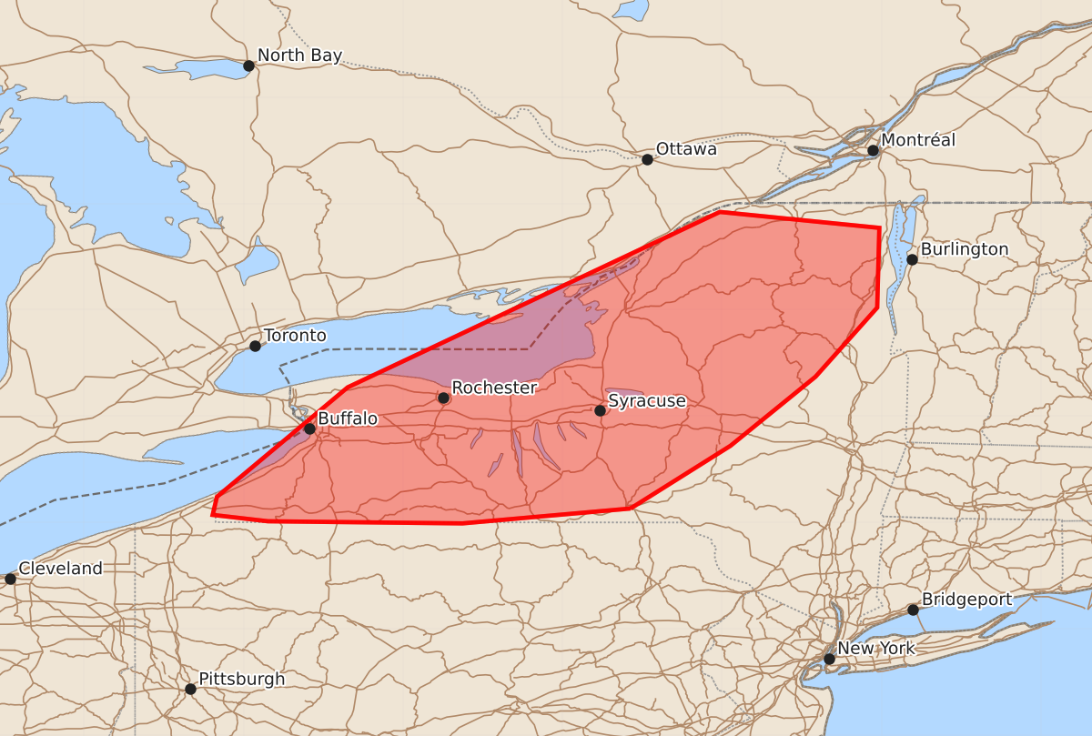
Increasingly intense thunderstorms are expected to move into western New York this afternoon, bringing the potential for damaging winds. These storms may produce wind gusts between 55 and 70 mph and hail up to 1.25 inches.
Product Text
000 ACUS11 KWNS 141758 SWOMCD SPC MCD 141758 NYZ000-PAZ000-141900- Mesoscale Discussion 1138 NWS Storm Prediction Center Norman OK 1258 PM CDT Sun Jun 14 2026 Areas affected...western New York Concerning...Severe potential...Watch possible Valid 141758Z - 141900Z Probability of Watch Issuance...60 percent SUMMARY...Thunderstorm coverage to increase in coverage and intensity through the afternoon. DISCUSSION...Thunderstorms are increasing in coverage and intensity along and ahead of a cold front across the Lower Great Lakes. This activity will spread eastward with time into western New York. Cloud cover remains across much of New York state but a few breaks in the clouds to the south and west are allowing for some heating to occur. Strong deep layer shear is in place across much of the region. As further heating occurs in the downstream environment, lapse rates will steepen with MLCAPE around 500 J/kg spreading northward. This will be sufficient to support severe potential through the afternoon. The primary risk will be for damaging winds. ..Thornton/Mosier.. 06/14/2026 ...Please see www.spc.noaa.gov for graphic product... ATTN...WFO...BTV...ALY...BGM...BUF...CTP...CLE... LAT...LON 42137586 41997744 42017927 42077979 42247975 43277852 44927502 44777352 44027354 43377412 42727492 42137586 MOST PROBABLE PEAK TORNADO INTENSITY...UP TO 90 MPH MOST PROBABLE PEAK WIND GUST...55-70 MPH MOST PROBABLE PEAK HAIL SIZE...UP TO 1.25 IN