Mesoscale Discussion 1203
Issued: · Valid: –
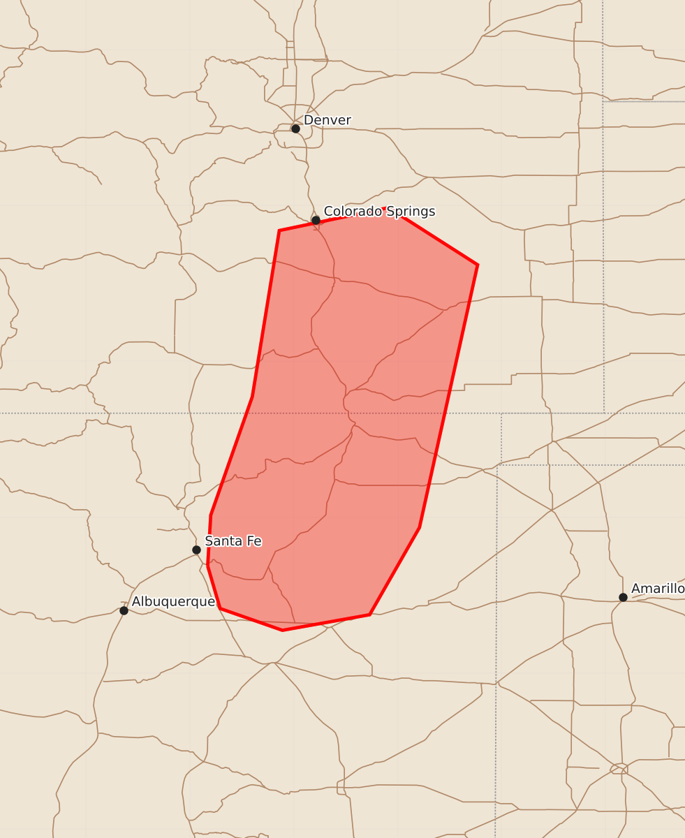
Summary
Isolated severe thunderstorms capable of producing large hail and damaging wind gusts are possible across central Colorado and north-central to northeast New Mexico this afternoon and into the early evening. These storms are expected to be infrequent and cover limited areas.
Product Text
000 ACUS11 KWNS 191944 SWOMCD SPC MCD 191943 COZ000-NMZ000-192215- Mesoscale Discussion 1203 NWS Storm Prediction Center Norman OK 0243 PM CDT Fri Jun 19 2026 Areas affected...central Colorado into north-central and northeast New Mexico Concerning...Severe potential...Watch unlikely Valid 191943Z - 192215Z Probability of Watch Issuance...5 percent SUMMARY...Isolated severe storms capable of large hail and locally severe wind gusts appear possible this afternoon into early evening. The limited areal coverage and magnitude of the severe-weather threat are expected to preclude a watch issuance. DISCUSSION...Recent trends in radar and satellite data indicate deepening showers and thunderstorms along the Sangre De Cristo Mountains and CO Front Range from near Las Vegas, NM to near Colorado Springs, CO. In the short term, thunderstorms are expected to remain in the vicinity of the high terrain owing to stronger capping across the adjacent High Plains. However, by mid to late afternoon, that capping is expected to weaken, allowing for a slow southeastward drift of the storms into lower elevations. The presence of steep, low/mid-level lapse rates and resultant MLCAPE of around 1000 J/kg is expected to coincide with 35-40 kt of effective bulk shear, supporting the potential for transient supercell structures capable of isolated occurrences of large hail and perhaps locally severe wind gusts. The limited areal coverage and magnitude of the severe-weather threat are expected to preclude a watch issuance. ..Mead/Hart.. 06/19/2026 ...Please see www.spc.noaa.gov for graphic product... ATTN...WFO...PUB...BOU...ABQ... LAT...LON 35530583 36020580 37160540 38760514 38980409 38430323 35900379 35060427 34910511 35120571 35530583 MOST PROBABLE PEAK WIND GUST...UP TO 60 MPH MOST PROBABLE PEAK HAIL SIZE...UP TO 1.25 IN