Mesoscale Discussion 1330
Issued: · Valid: –
Summary
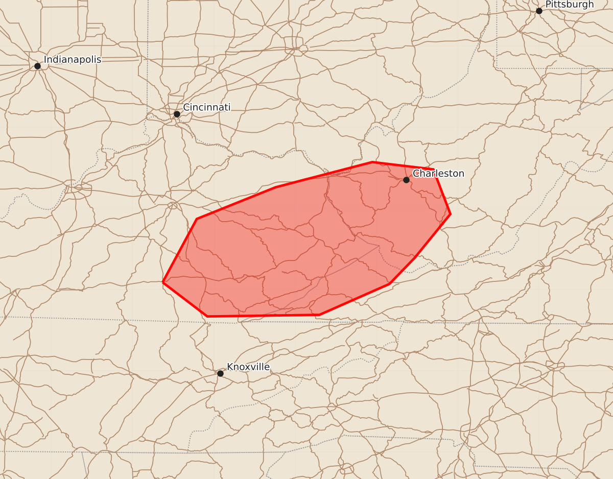
Damaging wind gusts up to 60 mph are possible this afternoon across eastern Kentucky and into western parts of West Virginia and Virginia.
Product Text
000 ACUS11 KWNS 261759 SWOMCD SPC MCD 261759 WVZ000-VAZ000-KYZ000-OHZ000-262000- Mesoscale Discussion 1330 NWS Storm Prediction Center Norman OK 1259 PM CDT Fri Jun 26 2026 Areas affected...eastern Kentucky into western parts of West Virginia and Virginia Concerning...Severe potential...Watch unlikely Valid 261759Z - 262000Z Probability of Watch Issuance...20 percent SUMMARY...The potential for a few damaging wind gusts is expected to increase this evening. Limited areal coverage and magnitude of threat are expected to preclude a watch issuance. DISCUSSION...Ahead of a well-defined MCV, a line of showers and thunderstorms has recently intensified in the vicinity of I-75, near Richmond. Daytime heating within the downstream air mass is contributing to destabilization with steep low-level lapse rates and MLCAPE of around 1000 J/kg evident in latest objective analysis. As such, expect the ongoing storms to further intensify while moving through eastern KY, potentially into western parts of WV and VA this afternoon. While relatively weak wind fields and resultant vertical shear are expected to limit the potential for an organized cold pool to evolve, locally damaging downburst winds appear possible given the presence of the steep low-level lapse rates. The anticipated areal coverage and magnitude of the damaging wind threat are currently expected to remain too marginal for a watch issuance. ..Mead/Guyer.. 06/26/2026 ...Please see www.spc.noaa.gov for graphic product... ATTN...WFO...RNK...RLX...MRX...JKL...LMK... LAT...LON 37098463 37878421 38268324 38578205 38488130 37938109 37398153 37078184 36698270 36678408 37098463 MOST PROBABLE PEAK WIND GUST...UP TO 60 MPH