Mesoscale Discussion 1435
Issued: · Valid: –
Summary
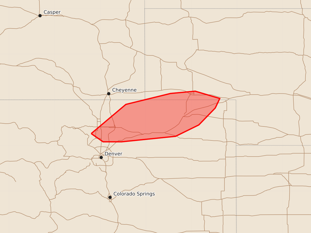
Isolated severe storms capable of producing large hail and strong wind gusts are possible overnight across northeast Colorado and the southern Nebraska Panhandle.
Product Text
000 ACUS11 KWNS 020658 SWOMCD SPC MCD 020658 COZ000-NEZ000-WYZ000-020900- Mesoscale Discussion 1435 NWS Storm Prediction Center Norman OK 0158 AM CDT Thu Jul 02 2026 Areas affected...Northeast CO into the southern NE Panhandle Concerning...Severe potential...Watch unlikely Valid 020658Z - 020900Z Probability of Watch Issuance...20 percent SUMMARY...Isolated severe storms are possible overnight. DISCUSSION...Strong to locally severe storms are ongoing across parts of northeast CO as of 0655 UTC. Moist low-level easterly flow beneath steep midlevel lapse rates is supporting moderate to locally strong buoyancy, with objectively analyzed MUCAPE values ranging from around 1000 J/kg north of Greeley to greater than 2000 J/kg into far northeast CO. Veering wind profiles and modest southwesterly flow aloft are resulting in effective shear of 30-40 kt, supportive of organized convection. Strong multicells and perhaps a supercell or two will remain possible through the early overnight, with a threat of large hail and localized strong/severe gusts. Thus far, storms have been relatively slow-moving, with a tendency toward some cell interference. This trend may continue, resulting in a generally isolated threat and making the need for a watch uncertain. However, watch issuance may be considered if trends support a greater coverage of severe threat overnight. ..Dean/Smith.. 07/02/2026 ...Please see www.spc.noaa.gov for graphic product... ATTN...WFO...LBF...BOU...CYS... LAT...LON 40260520 40900444 41140346 41190292 41030238 40820248 40450284 40200335 40080453 40080494 40260520 MOST PROBABLE PEAK WIND GUST...55-70 MPH MOST PROBABLE PEAK HAIL SIZE...1.50-2.50 IN