Mesoscale Discussion 1440
Issued: · Valid: –
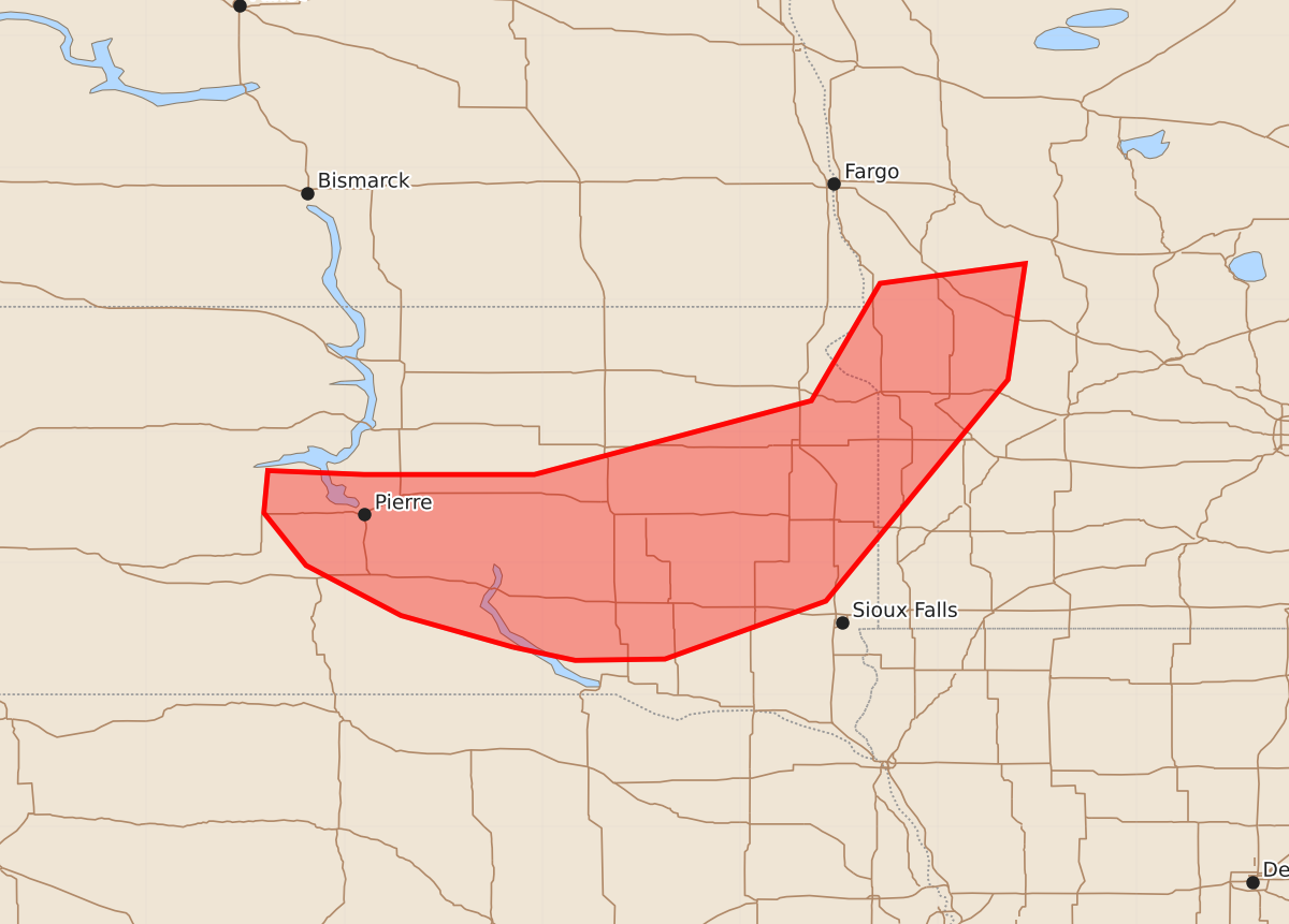
Summary
Supercell thunderstorms capable of producing large hail, severe winds, and possibly tornadoes may develop across central and eastern South Dakota into far western Minnesota this afternoon. These storms are expected to increase in threat level over the next one to two hours.
Product Text
000 ACUS11 KWNS 021827 SWOMCD SPC MCD 021826 MNZ000-SDZ000-022000- Mesoscale Discussion 1440 NWS Storm Prediction Center Norman OK 0126 PM CDT Thu Jul 02 2026 Areas affected...central/eastern South Dakota into far western Minnesota. Concerning...Severe potential...Watch possible Valid 021826Z - 022000Z Probability of Watch Issuance...60 percent SUMMARY...Increasing supercell threat over the next 1 to 2 hours. DISCUSSION...A region of ascent associated with a mid-level shortwave trough pivoting out of Nebraska and into southern South Dakota has now interacted with the outflow boundary from morning convection across south-central South Dakota. 2500 to 3000 J/kg MLCAPE in this region will support robust updraft development. Moderate to strong deep-layer shear (40 to 45 knots) will support supercell storm mode. The biggest question will be storm longevity in the short term. An earlier supercell across central South Dakota eventually became disconnected from the outflow boundary as it moved south. This boundary is still moving south, but somewhat slower than earlier with warming on the cool side of the boundary. Therefore, the potential for one or more supercells to latch on to this boundary is likely higher now. If it appears storms will remain rooted to the boundary, a severe thunderstorm watch may be needed. However, it remains possible these early storms move quickly into the more stable airmass and are only short lived. Any mature supercells which develop will have a threat for large hail, severe winds, and perhaps a tornado. The outflow boundary across eastern South Dakota and far western Minnesota has mostly stalled with some towers noted on satellite imagery. A few supercells may develop within this area as mid-level ascent approaches. If these supercells develop, it might also necessitate a severe thunderstorm watch. ..Bentley/Hart.. 07/02/2026 ...Please see www.spc.noaa.gov for graphic product... ATTN...WFO...MPX...FGF...FSD...ABR...UNR... LAT...LON 43369922 43600007 43980079 44380111 44700108 44670035 44679906 44969797 45239696 46129644 46279534 45399547 43719685 43279807 43269875 43369922 MOST PROBABLE PEAK TORNADO INTENSITY...UP TO 90 MPH MOST PROBABLE PEAK WIND GUST...65-80 MPH MOST PROBABLE PEAK HAIL SIZE...1.50-2.50 IN