Mesoscale Discussion 1757
Issued: · Valid: –
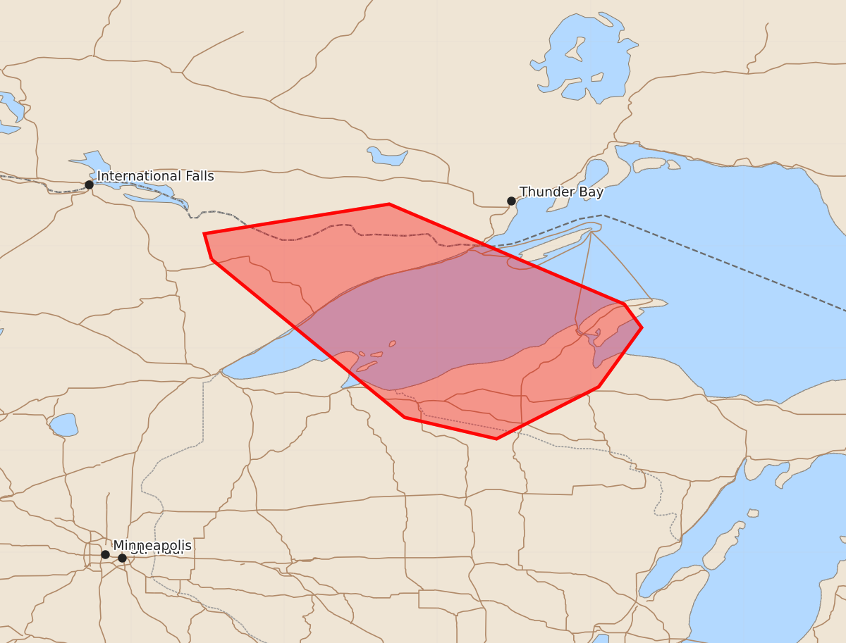
Summary
Severe thunderstorms capable of producing large hail and isolated wind damage will move through the Minnesota Arrowhead, far northern Wisconsin, and the western Upper Peninsula of Michigan early this morning.
Product Text
000 ACUS11 KWNS 271027 SWOMCD SPC MCD 271026 MIZ000-WIZ000-MNZ000-271230- Mesoscale Discussion 1757 NWS Storm Prediction Center Norman OK 0526 AM CDT Mon Jul 27 2026 Areas affected...Minnesota Arrowhead...far northern Wisconsin...western Upper Peninsula of Michigan Concerning...Severe Thunderstorm Watch 518... Valid 271026Z - 271230Z The severe weather threat for Severe Thunderstorm Watch 518 continues. SUMMARY...Large hail will be the primary risk with elevated storms moving southeastward through the Minnesota Arrowhead early this morning. Isolated wind damage is also possible with the strongest storms. DISCUSSION...Low-level warm advection and lift from a shortwave trough have reinvigorated convection across the Minnesota Arrowhead early this morning. Steep mid-level lapse rates and effective shear of 40-50 kts will help to organize storms promote a risk of large hail. Though this activity is elevated, stronger downdrafts could reach the surface and produce isolated damage. These risk will eventually extend into far northern Wisconsin and the western Upper Peninsula of Michigan. ..Wendt.. 07/27/2026 ...Please see www.spc.noaa.gov for graphic product... ATTN...WFO...MQT...GRB...DLH... LAT...LON 47879221 48129228 48419047 47438817 47208800 46628842 46118942 46329032 47879221 MOST PROBABLE PEAK WIND GUST...UP TO 60 MPH MOST PROBABLE PEAK HAIL SIZE...1.00-1.75 IN