Mesoscale Discussion 1332
Issued: · Valid: –
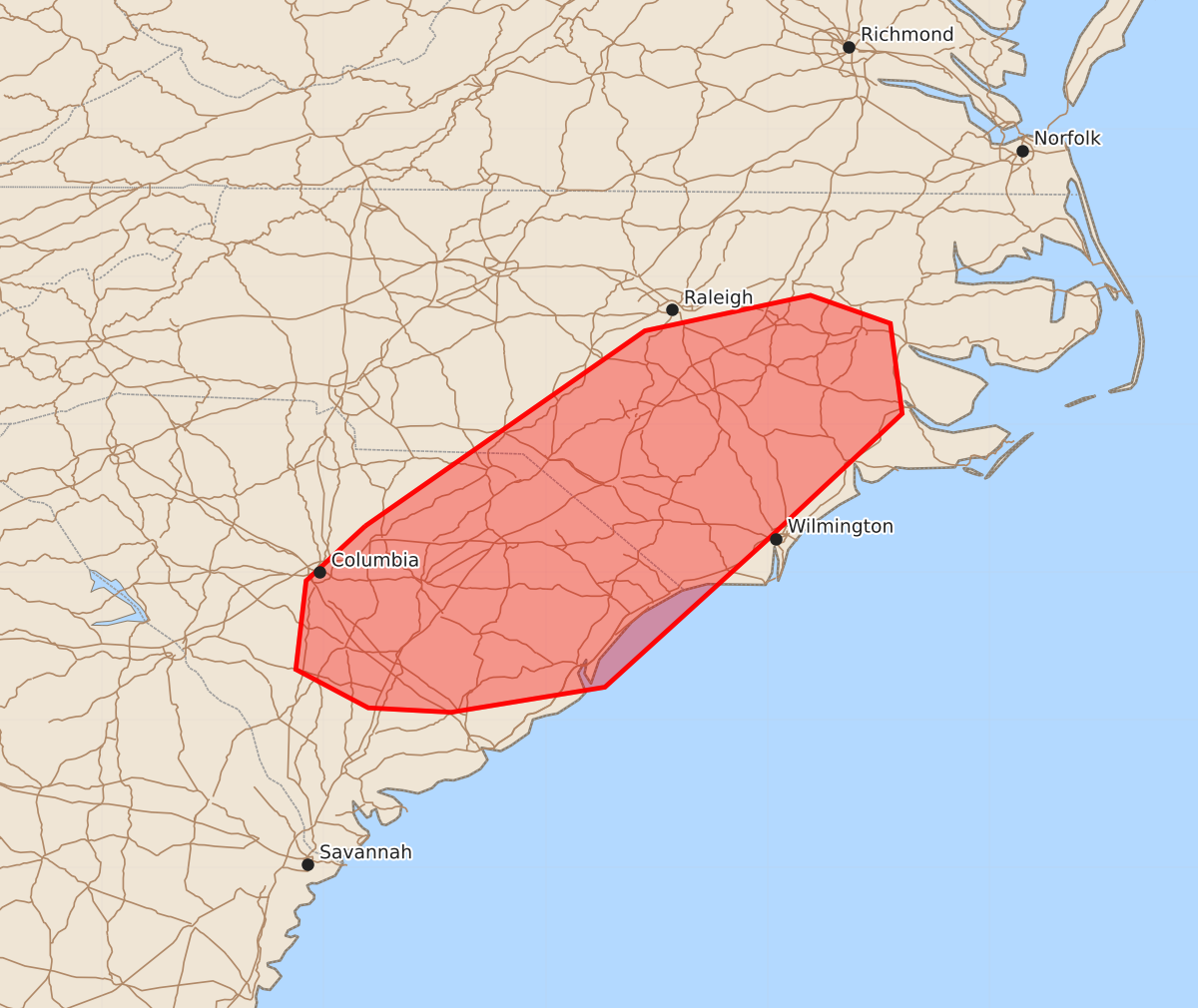
Summary
Scattered thunderstorms may produce sporadic damaging wind gusts of up to 60 mph across portions of the coastal Carolinas this afternoon.
Product Text
000 ACUS11 KWNS 261858 SWOMCD SPC MCD 261858 NCZ000-SCZ000-262130- Mesoscale Discussion 1332 NWS Storm Prediction Center Norman OK 0158 PM CDT Fri Jun 26 2026 Areas affected...portions of the coastal Carolinas Concerning...Severe potential...Watch unlikely Valid 261858Z - 262130Z Probability of Watch Issuance...20 percent SUMMARY...A damaging gust or two is possible this afternoon across portions of the coastal Carolinas. A watch is not anticipated. DISCUSSION...A seasonably moist air mass is in place across portions of the eastern Carolinas, where convective temperatures have been reached, resulting in scattered thunderstorms ongoing this afternoon. The KLTX VWP shows generally weak flow, which correlates with the single- and multicell modes apparent on radar. Due to the high precipitable water values (>2 in) in place across the region, water loading in downdrafts may be enough for some damaging gusts across the region. Additionally, storms may cluster with time, and this may slightly increase the threat for damaging gusts. However, this threat is still expected to be fairly sporadic, and therefore a watch is not expected at this time. ..Supinie/Guyer.. 06/26/2026 ...Please see www.spc.noaa.gov for graphic product... ATTN...WFO...MHX...RAH...ILM...CHS...CAE... LAT...LON 34318072 35637883 35877771 35687717 35077709 34207802 33227910 33058014 33088070 33348119 33948112 34318072 MOST PROBABLE PEAK WIND GUST...UP TO 60 MPH