Day 4-8 Convective Outlook
Issued: · Valid: –
Summary
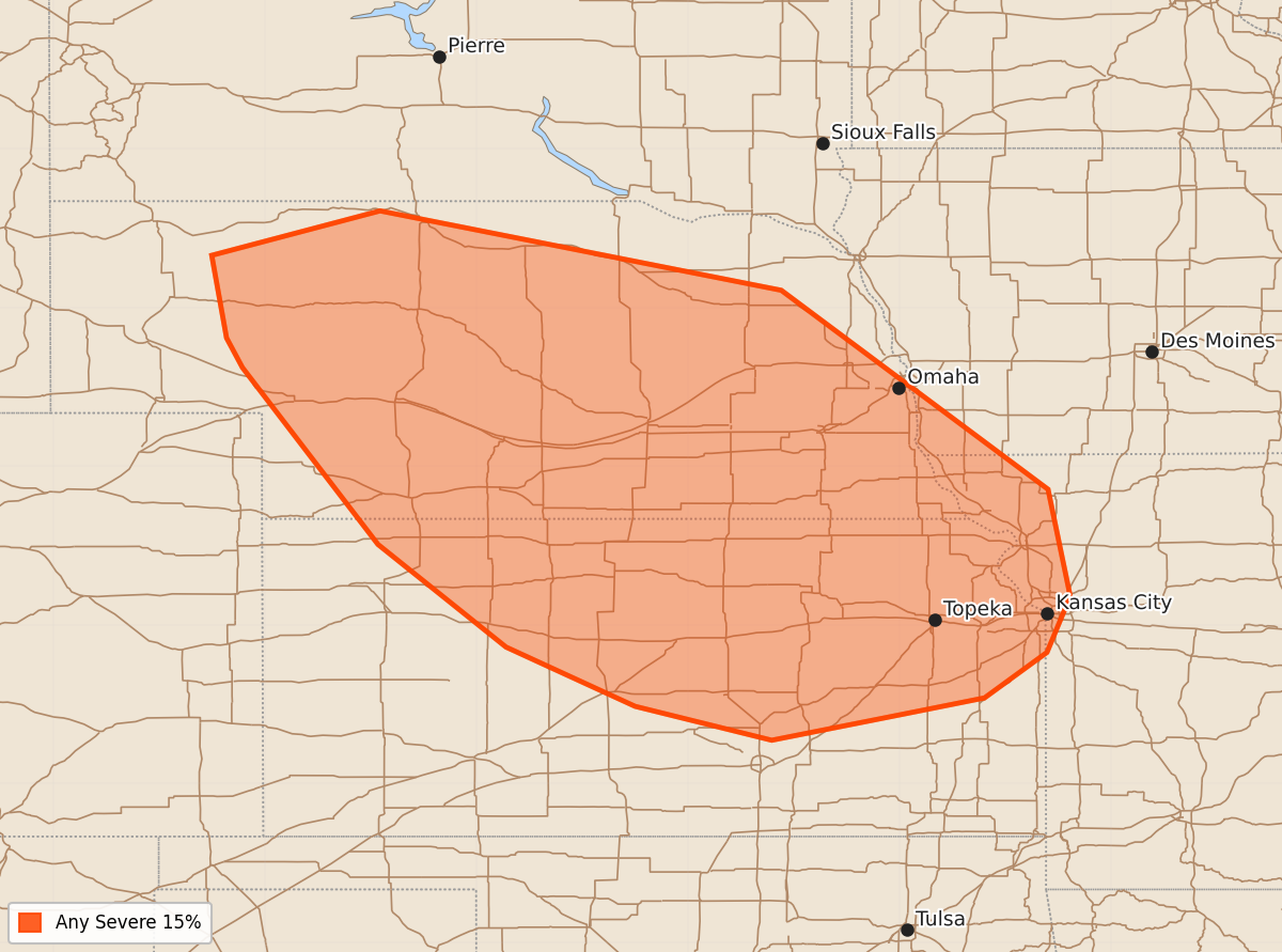
Severe thunderstorms are expected to develop across parts of Kansas and Nebraska from late Saturday afternoon through the overnight hours. Widespread convection is also likely to occur across the Carolinas on Friday morning.
Product Text
000 ACUS48 KWNS 160755 SWOD48 SPC AC 160753 Day 4-8 Convective Outlook NWS Storm Prediction Center Norman OK 0253 AM CDT Tue Jun 16 2026 Valid 191200Z - 241200Z ...DISCUSSION... ...Day 4/Fri - Carolinas... A very moist airmass will be in place across the Carolinas vicinity on Friday. Medium range guidance varies in the evolution of a surface front across the region. However, widespread convection is likely to be ongoing Friday morning somewhere across the Southeast. This will likely temper downstream destabilization and severe potential is uncertain. ...Day 5/Sat - Central Plains... Upper ridging over the Plains will break down on Saturday as an upper shortwave impulse ejects from the central Rockies toward the Mid-MO Valley. At the same time, lee surface low development over the central High Plains will strengthen south/southeasterly low-level flow and rich Gulf moisture will quickly stream northward across portions of KS/NE. Moderate to strong destabilization amid strengthening west/northwesterly flow aloft will support severe thunderstorm development from late afternoon into the overnight hours. ...Days 6-8/Sun-Tue... Spread among forecast guidance increases late in the forecast period. However, the general consensus is for weakening flow aloft and upper ridging building across the western U.S. Overall, predictability is low for early next week. ..Leitman.. 06/16/2026