Mesoscale Discussion 1743
Issued: · Valid: –
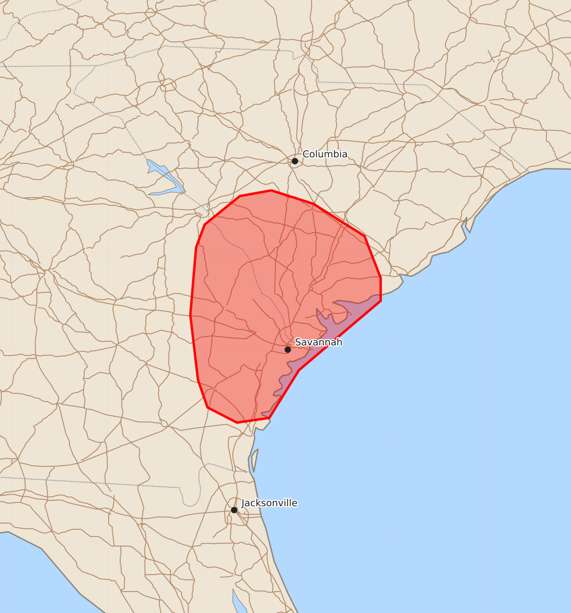
Summary
Scattered thunderstorms are expected across eastern Georgia and southern South Carolina through the early evening, with a possibility of damaging wind gusts up to 60 mph. The overall severe weather threat for the area is expected to remain limited.
Product Text
000 ACUS11 KWNS 262024 SWOMCD SPC MCD 262024 SCZ000-GAZ000-262230- Mesoscale Discussion 1743 NWS Storm Prediction Center Norman OK 0324 PM CDT Sun Jul 26 2026 Areas affected...Eastern Georgia and southern South Carolina Concerning...Severe potential...Watch unlikely Valid 262024Z - 262230Z Probability of Watch Issuance...5 percent SUMMARY...Scattered thunderstorms are likely across far eastern Georgia and southern South Carolina through early evening, and a few damaging gusts appear possible. However, the overall severe threat should remain limited. DISCUSSION...Over the past hour, GOES and reflectivity imagery have shown gradually deepening convective showers across far eastern GA and southern SC in proximity to a subtle surface low and along the flanks of a cold pool established by prior convection to the north of the Charleston, SC area. Weak low-level convergence coupled with further diurnal heating should promote continued, but slow, deepening/intensification of convection through early evening. In proximity to this activity, temperatures in the 90s are supporting ~20 F dewpoint depressions that suggest boundary-layer depth is approaching 1.5 to 2 km. These low-level thermodynamic conditions are favorable for strong downbursts capable of producing damaging gusts (maximum wind speeds most likely of 40-60 mph). Given the number of incipient convective cells across the region, at least a couple instances of damaging winds appear possible. However, modest deep-layer wind shear and weak broad-scale ascent across the region should modulate overall convective intensity and longevity, precluding the need for a watch. ..Moore/Leitman.. 07/26/2026 ...Please see www.spc.noaa.gov for graphic product... ATTN...WFO...CHS...CAE...JAX...FFC... LAT...LON 33698128 33558084 33218030 32778013 32538013 31808099 31308130 31258164 31418195 31708205 32388213 33098207 33338198 33638161 33698128 MOST PROBABLE PEAK WIND GUST...UP TO 60 MPH