Mesoscale Discussion 2006
Issued: · Valid: –
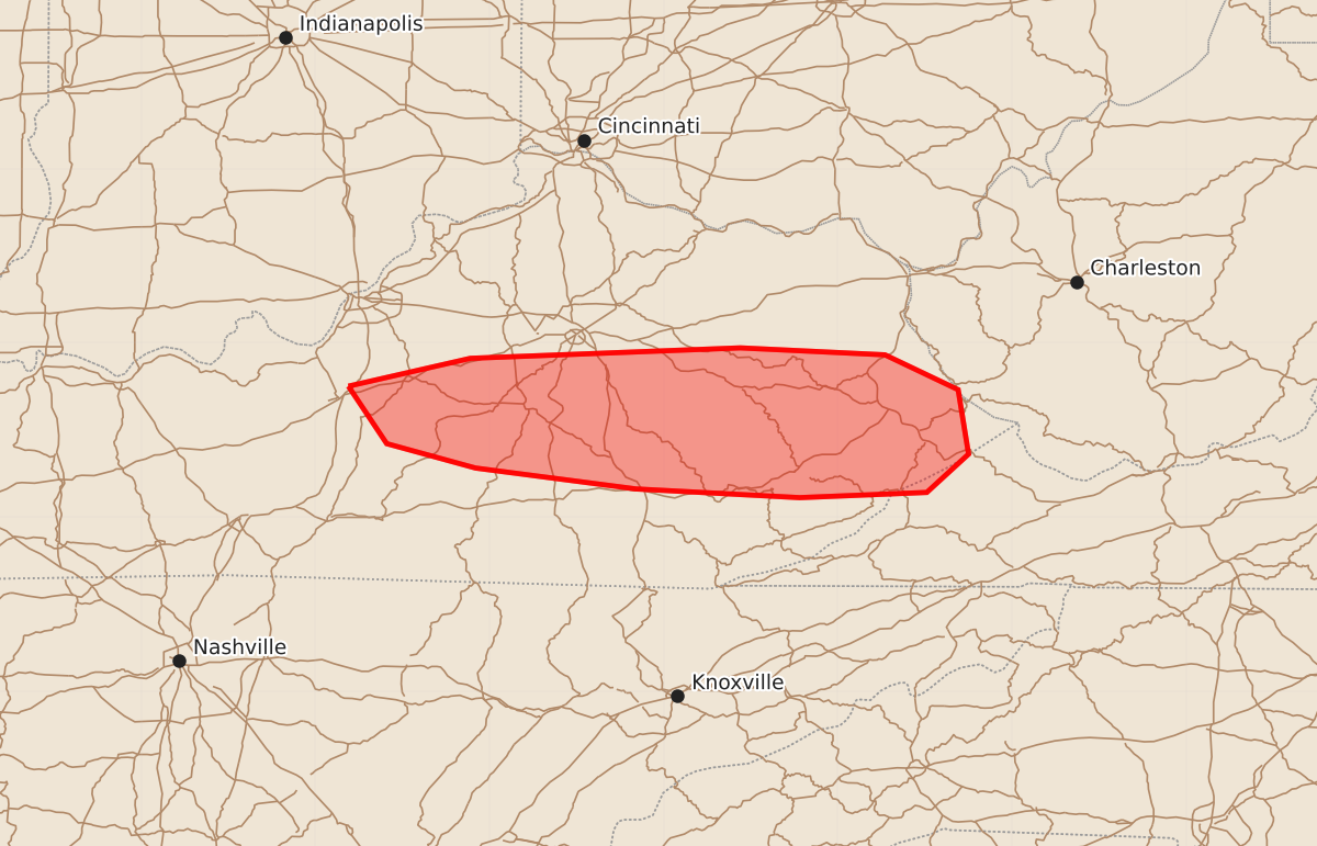
Summary
Isolated strong thunderstorms capable of producing damaging wind gusts may affect portions of central and eastern Kentucky this evening.
Product Text
000 ACUS11 KWNS 162335 SWOMCD SPC MCD 162334 WVZ000-KYZ000-VAZ000-170100- Mesoscale Discussion 2006 NWS Storm Prediction Center Norman OK 0634 PM CDT Sun Aug 16 2026 Areas affected...portions of central and eastern Kentucky Concerning...Severe potential...Watch unlikely Valid 162334Z - 170100Z Probability of Watch Issuance...20 percent SUMMARY...A couple of damaging gusts are possible with the stronger storms this evening. The severe threat is expected to remain isolated, so a WW issuance is not expected. DISCUSSION...Thunderstorms have intensified over the past few hours along a convective outflow boundary from earlier storms, with a 49 kt gust recently noted with the KLOU ASOS. These storms are impinging on a well-heated airmass, with surface temperatures still at or near 90 F, amid 0-3 km lapse rates approaching 7 C/km. While the boundary layer remains mixed, a few of the stronger storms may produce damaging gusts. However, given the lack of stronger vertical wind shear and the anticipated onset of nocturnal cooling, the severe threat should remain limited, precluding a WW issuance. ..Squitieri/Gleason.. 08/16/2026 ...Please see www.spc.noaa.gov for graphic product... ATTN...WFO...RLX...MRX...JKL...LMK... LAT...LON 37758581 37918511 37978356 37938273 37738231 37368225 37148249 37118322 37168416 37288508 37428559 37758581 MOST PROBABLE PEAK WIND GUST...55-70 MPH