Mesoscale Discussion 1464
Issued: · Valid: –
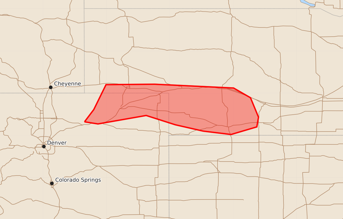
Summary
Isolated hail and strong wind gusts are possible overnight across parts of southwest Nebraska and northeast Colorado. These storms could bring severe conditions including wind gusts up to 70 mph and hail up to 1.75 inches.
Product Text
000 ACUS11 KWNS 030727 SWOMCD SPC MCD 030726 NEZ000-COZ000-030930- Mesoscale Discussion 1464 NWS Storm Prediction Center Norman OK 0226 AM CDT Fri Jul 03 2026 Areas affected...Parts of southwest NE and northeast CO Concerning...Severe potential...Watch unlikely Valid 030726Z - 030930Z Probability of Watch Issuance...20 percent SUMMARY...Isolated hail and strong to locally severe gusts are possible overnight. DISCUSSION...A band of storms has intensified early this morning from northeast CO into southwest NE. Model-based soundings suggest that this activity is based around 700 mb, with intensifying low-level southerly flow from the KGLD VWP indicative of a strengthening warm-advection regime. Steep midlevel lapse rates and MUCAPE of greater than 2000 J/kg will result in a hail threat with the strongest updrafts, though modest deep-layer shear and a generally linear storm mode may temper this potential to some extent. Localized strong to severe gusts also cannot be ruled out, given the presence of a relatively dry boundary layer and potential for strong downdrafts. Short-term guidance suggests that this band of storms will continue to move north-northeastward with time, with an isolated severe threat potentially spreading across the southern NE Panhandle and a larger portion of southwest NE. ..Dean/Mosier.. 07/03/2026 ...Please see www.spc.noaa.gov for graphic product... ATTN...WFO...GID...LBF...GLD...BOU...CYS... LAT...LON 40320402 40610380 41200351 41210236 41120049 40890009 40439990 40209994 40020055 40100121 40250187 40470256 40270370 40320402 MOST PROBABLE PEAK WIND GUST...55-70 MPH MOST PROBABLE PEAK HAIL SIZE...1.00-1.75 IN