Mesoscale Discussion 1455
Issued: · Valid: –
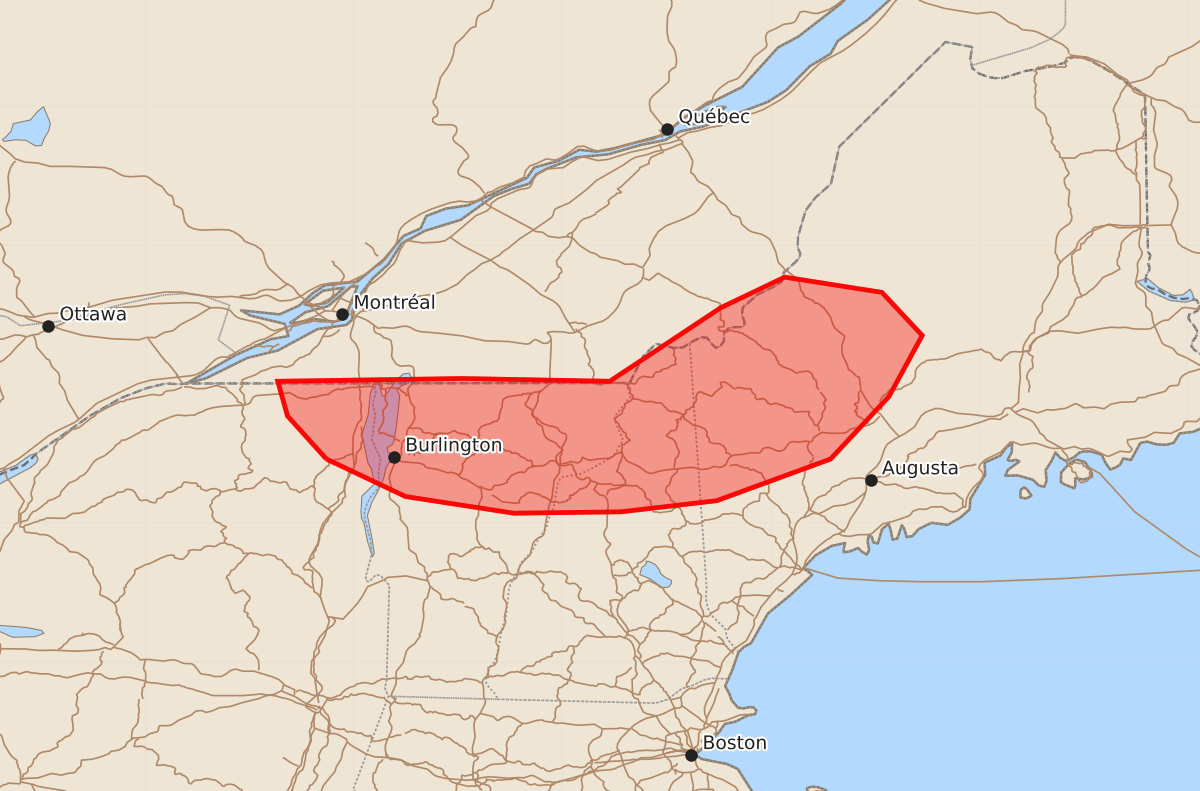
Summary
A band of thunderstorms moving across the international border may bring damaging wind gusts up to 60 mph to parts of northeastern New York, northern Vermont, New Hampshire, and western Maine during the evening hours.
Product Text
000 ACUS11 KWNS 030014 SWOMCD SPC MCD 030013 MEZ000-NHZ000-VTZ000-NYZ000-030215- Mesoscale Discussion 1455 NWS Storm Prediction Center Norman OK 0713 PM CDT Thu Jul 02 2026 Areas affected...Far northeast New York into northern Vermont...New Hampshire...and western Maine Concerning...Severe potential...Watch unlikely Valid 030013Z - 030215Z Probability of Watch Issuance...20 percent SUMMARY...A band of thunderstorms cross the international border may pose a damaging wind threat in the coming hours across portions of the Northeast. Watch issuance is not likely, however. DISCUSSION...Latest MRMS mosaics show a broken band of storms migrating eastward across southern Quebec and beginning to cross/approach the international border. Velocity data from CASBV shows some pockets of stronger winds, but an outflow boundary is also noted emanating from the southwestern flank of the band. This suggests that while some swaths of strong/damaging winds are possible in the near term, the near-storm environment is not favorable for additional development. Furthermore, GOES IR imagery has shown some degree of cloud-top warming over the past hour, suggesting a slight weakening trend. Nonetheless, recent RAP mesoanalysis depicts 30-40 knots of effective shear and around 1500 J/kg MLCAPE across the region that may support these bands for the next couple of hours. Based on the aforementioned velocity observations, some threat for damaging winds will likely accompany these storms. With time, nocturnal cooling will promote increasing inhibition and will act as a modulating factor for thunderstorm intensity, which should limit the overall severe risk and negate the need for a watch. ..Moore/Guyer.. 07/03/2026 ...Please see www.spc.noaa.gov for graphic product... ATTN...WFO...CAR...GYX...BTV... LAT...LON 44467370 44777398 45027405 45047272 45027166 45557086 45777040 45666970 45356941 44916965 44467007 44167089 44087158 44077235 44197313 44467370 MOST PROBABLE PEAK WIND GUST...UP TO 60 MPH MOST PROBABLE PEAK HAIL SIZE...UP TO 1.25 IN