Day 3 Convective Outlook
Issued: · Valid: –
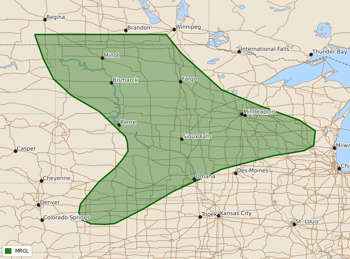
Summary
Isolated severe thunderstorms capable of producing damaging wind and hail are possible across parts of the central and northern Plains into the Upper Mississippi Valley on Sunday.
Product Text
000 ACUS03 KWNS 281918 SWODY3 SPC AC 281916 Day 3 Convective Outlook NWS Storm Prediction Center Norman OK 0216 PM CDT Fri Aug 28 2026 Valid 301200Z - 311200Z ...THERE IS A MARGINAL RISK OF SEVERE THUNDERSTORMS FOR PARTS OF THE NORTHERN AND CENTRAL PLAINS INTO THE UPPER MISSISSIPPI VALLEY... ...SUMMARY... At least isolated severe storms, accompanied by mainly a severe wind and hail threat, are possible across portions of the central and northern Plains into the Upper Mississippi Valley on Sunday. ...Synopsis... The upper-level low across the Pacific Northwest will lift northward into Canada on D3/Sunday as the ridge across the central US shifts gradually eastward. Multiple shortwave troughs will rotate through the northern periphery of the ridge across northern Rockies into the northern Plains, with strengthening mid-level flow overspreading the northern Plains. A surface low will develop across the northern Plains, preceded by a warm front that extends from the Dakotas into the Upper MS Valley as a cold front sags south-southeastward across the central Plains. ...Portions of the Northern Plains to the Upper MS Valley... Multiple rounds of thunderstorms are expected through the morning and evening of D3/Sunday. Convection will likely be ongoing at the start of the period across the Dakotas into central Minnesota near the warm front within the warm advection regime, with some potential for damaging wind and transient supercell structures given strong shear profiles. A mix of multicells and supercells may redevelop by the afternoon/early evening from eastern Montana into the western/central Dakotas, with one or more clusters potentially growing upscale into an MCS. Severe wind and hail will be the main threats with multicell/supercell structures, with perhaps some risk of a wind swath should an MCS materialize. ...Portions of the Central Plains... Further south across the central Plains, more substantial capping leads to a more conditional threat. The strengthening low-level jet in the evening may aid in overcoming MLCIN and development of elevated convection. Supercell wind profiles will be in place with steep lapse rates and moderate to strong instability. Should storms be able to initiate, they will pose a wind and hail risk into the late evening. ..Thornton.. 08/28/2026 $$