Day 1 Convective Outlook
Issued: · Valid: –
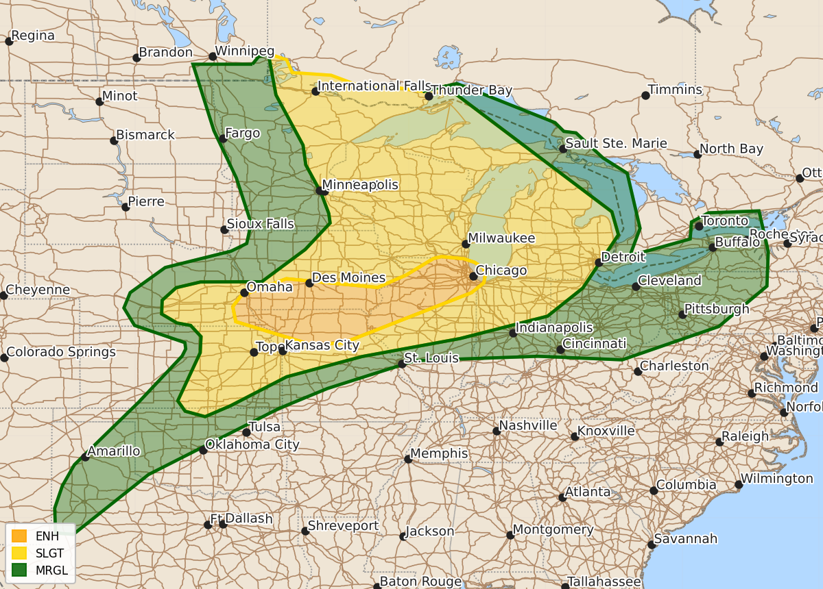
Summary
Scattered to numerous severe thunderstorms capable of producing large hail, damaging winds over 75 mph, and a few tornadoes will impact parts of the Upper Mississippi Valley, the Midwest, and the central Plains through this evening and overnight. The threat may expand into the Ohio Valley by early Thursday morning.
Product Text
000 ACUS01 KWNS 110121 SWODY1 SPC AC 110119 Day 1 Convective Outlook NWS Storm Prediction Center Norman OK 0819 PM CDT Wed Jun 10 2026 Valid 110100Z - 111200Z ...THERE IS AN ENHANCED RISK OF SEVERE THUNDERSTORMS ACROSS PORTIONS OF THE UPPER MISSISSIPPI VALLEY INTO PARTS OF THE PLAINS... ...SUMMARY... Scattered to numerous severe thunderstorms with potential for large hail, a couple of tornadoes and damaging winds with gusts over 75 mph will continue this evening across parts of the Upper Mississippi Valley and Midwest. ...Synopsis... A cold front extends from portions of the upper Midwest into the central Plains, with a surface low over Manitoba. Several lines and clusters of severe thunderstorms continue along and ahead of this feature across portions of the Great Lakes into the Midwest and central/southern Plains. The risk for damaging wind, large hail, and a couple of tornadoes will continue into the evening across these regions extending into the Ohio Valley overnight. ...Central Kansas, northwest Missouri and Iowa... Widespread thunderstorm development continues across central Kansas into central Iowa along the cold front. Initial development is supercelluar and pose a risk for large hail, damaging wind, and perhaps a tornado. Linear forcing along the front will likely lead to upscale growth, with the primary threat becoming damaging wind. Ongoing convection further west into southern Iowa/northwest Missouri is remaining a mixed-mode of supercells and multi-cell clusters. Within this area, strong instability and deep layer shear may continue to pose a risk for a tornado or two while storm mode remains semi-discrete. The 10% tornado risk and 30% hail risk areas were removed with this update given the tendency for more linear storm modes. ...Eastern Nebraska/far western Iowa and northern Illinois... Latest forecast guidance continues to show a signal for elevated convection near the terminus of a low-level jet across eastern NE/western IA late tonight/early Thursday morning. Forecast soundings from these solutions, most notably recent RAP runs and the NAM, hint that low-level moisture advection may be sufficient to support parcels rooted near the surface. Initial thunderstorms may pose a risk for hail before growing upscale into a damaging MCS into the end of the current D1 period tomorrow morning. A 30% wind area was introduced into southeastern Nebraska/southern Iowa in support of recent HRRR runs which show potential for a swath of damaging wind across far eastern Nebraska into southern Iowa. ..Thornton.. 06/11/2026 $$