Mesoscale Discussion 1817
Issued: · Valid: –
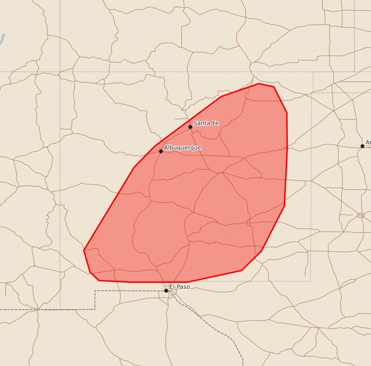
Summary
Thunderstorms increasing across portions of New Mexico this afternoon may produce marginal hail and strong wind gusts.
Product Text
000 ACUS11 KWNS 011857 SWOMCD SPC MCD 011857 NMZ000-TXZ000-012100- Mesoscale Discussion 1817 NWS Storm Prediction Center Norman OK 0157 PM CDT Sat Aug 01 2026 Areas affected...portions of New Mexico Concerning...Severe potential...Watch unlikely Valid 011857Z - 012100Z Probability of Watch Issuance...20 percent SUMMARY...Thunderstorms coverage will increase through the afternoon. A few storms could produce strong outflow wind gusts or marginal hail. A watch is not currently expected. DISCUSSION...Strong heating has allowed temperatures to warm into the 80s to low 90s across lower elevated in central/eastern NM early this afternoon. Coupled with steep mid and low-level lapse rates, modest destabilization has occurred, while inhibition continues to erode. Low-level winds have largely become east/southeasterly in the post-frontal upslope flow regime. This is resulting in initial early afternoon convection over higher terrain. Moderate northerly flow aloft is supporting in sufficient vertical shear for loosely organized cells. This initial activity may be capable of small/marginally severe hail, particularly across the northern half of the MCD area where midlevel temperatures are cooler through the bulk of the elevated instability layer. As storms track south with time across the hotter and steep low-level lapse rates environment in lower elevations, sporadic strong outflow gusts will be possible. Given the overall marginal parameter space and transient nature of any stronger updrafts, a watch is not currently expected. ..Leitman/Mosier.. 08/01/2026 ...Please see www.spc.noaa.gov for graphic product... ATTN...WFO...MAF...ABQ...EPZ... LAT...LON 36410520 36720430 36640394 36020363 35190362 34570365 33800369 32720424 32260471 31980601 31980737 32020812 32220833 32740848 34720728 35230678 36410520 MOST PROBABLE PEAK WIND GUST...UP TO 60 MPH MOST PROBABLE PEAK HAIL SIZE...UP TO 1.25 IN